Please be careful when viewing info-graphics of extreme snow totals. There is always one computer that is an outlier.
Snow storm is looking likely this weekend.
We are within the three day forecast range so it can be said with certainty that there will be snow in south central Indiana Saturday night. I expect winter weather advisories and watches to go up tomorrow evening.
Ahoy!
50 degrees today and then cold and snowy this weekend. Exact timing and amounts are uncertain. Expect this up and down see-saw effect to continue throughout March.
More rain is on the way!
I hate to say it but more rain is coming next week. I am also noticing a pattern developing. The preferred storm track looks like this:
This puts Indiana in the warm and rainy side of the storm track. Here's the new GFS-FV3 model run for the next 384 hours.
There's a chance for some ice tomorrow so please be aware of the weather when traveling. The models have been going back and forth over precipitation types.
Here is the upper air sounding for Bloomington. Note the precipitation type in the bottom right-hand corner.
Warmer and rainy on Monday and Tuesday. Dry on Wednesday. Rain & snow for Thursday and Friday.
A mixed soup kind of day.
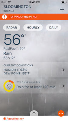
A wild day in store of us. Wind, rain, snow, slight risk of strong storms, a small chance of tornadoes south, flooding, a high of 63 and a low of 16.
Indiana Weather!
Thursday's high temperature will be 65. Friday night's low temperature will be 10. Here's the long story from the NWS:
_______
_______
Once the front passes Thursday evening...intense cold advection
commences immediately with temperatures crashing rapidly.
Equivalent potential temp profiles go vertical for a few hours
Thursday night and combined with a strong surface pressure
gradient and the cold advection...expect wind gusts to periodically
approach 35 to possibly 40 mph for several hours Thursday night.
Also not out of the question for precipitation to end as a few
snowflakes late Thursday evening but not anticipating any impact.
One impact that may need to be considered for the Friday morning
commute is the potential for a flash freeze as temperatures drop 30-
35 degrees from sunset Thursday to daybreak Friday. The gusty winds
may help to mitigate this concern somewhat and dry surfaces...but
this will be something to monitor.

A strong area of high pressure will expand across the area from the
Canadian prairies for Friday with dry and much colder air returning.
Expect plenty of sunshine Friday and a continuation of gusty flow as
the pressure gradient remains tight. Winds will relax Friday night
as the core of the high moves into the region.

Temps...the roller coaster ride continues with the temperatures.
After highs climbing into the low and mid 60s over much of the
forecast area Thursday...expect highs only in the 20s Friday. A mild
night tonight with temperatures remaining in the 50s in some areas
will fall all the way into the single digits and teens by Friday
night. An overall model blend worked reasonable for most periods
with a lean towards the MAVMOS. Subzero wind chills are possible for
some Friday and Friday night.

&&

.LONG TERM /Saturday through Tuesday/...
Issued at 227 AM EST Wed Feb 6 2019

Ensembles are in good agreement overall in suggesting a
progressive nature to the long wave features during this period.
Mean upper ridging over the local area this weekend will drift off
to the east, while upper troughing moves into the Plains by next
Tuesday.

Despite the overall agreement with the main features, there are
considerable differences among the individual members as to the
timing, track, and intensity of disturbances that may eject out of
the approaching western trough. For now, will broadbrush PoPs for
mixed precipitation from Sunday through the end of the forecast
period. PoPs will probably need fine tuning as trends to the
disturbances get established with time. At this time, ensembles
suggest potential for some accumulating snow at times.

&&
Hilarious!
It was so cold that my Amazon shipment via UPS was delayed due to "weather or a natural disaster". That's a first for me.
Subscribe to:
Comments (Atom)


