Rain tonight and into Thursday morning.

The golfing forecast: It's a terrible day to play golf today because of the wind. All shots will look like shanks. That is a real term for golfing so please don't get angry with me.

The wind hasn't been bad as it was expected to be but the Wind Advisory is still in place until 10:00pm tonight. Rain and storms arrive around 7:00pm and last until 6:00am. The severe weather potential is between 9:00pm and 1:00am. The dewpoint hits 56 degrees around 10:00pm so that is the time to watch out.

In other news, winter is still trying to hang on. Check -1 temperature in Canada, just above Michigan for April 17th.


Freezing in Indiana on April 21st.


Snow in April again this year?


Happy Monday!

Enjoy the day! Today will be the best day of the week so get out and enjoy it if you can. It's going to rain Tuesday - Thursday and there's a chance for some snow this weekend.


Spot on!

This guy is right about winters's return, particularly a January type air mass. See my post below this one.


Saturday is going to be beautiful but...

The high temperature tomorrow will be 72. That's just perfect! Get out and enjoy yourselves but remember that winter is not over. 

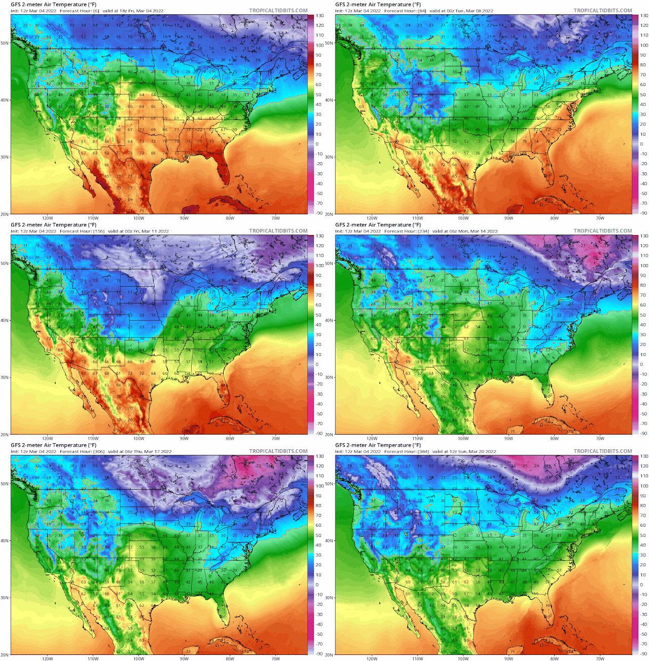
Projected temperatures for March 13


Projected temperature for April 3


Snow on March 8?


Snow on March 12?


Overall trends in temperatures and precipitation for the next 12 days


From the National Weather Service:

.Long Term...(Sunday through Friday)
Issued at 258 PM EST Fri Mar 4 2022

Early Sunday, mid-upper level shortwave trough now over southern
California is expected to be over the Great Lakes. Warm advection-
driven precipitation regime should be well to our northeast, and
midlevel dry conveyor belt will have overspread Indiana by then.
Residual precipitation should be relegated south and east of our
area associated with warm conveyor belt and anomalous integrated
water vapor transport values. Westward of the deeper
saturation/precipitation but ahead of lagging surface front, low
level moisture may be sufficient enough for lingering drizzle and
low clouds early Sunday.

By midday, the front will be southeast of the area but will be
increasingly flow-parallel and thus progressing much slower.
Meanwhile, increased mixing and deepening PBL amidst departing low
level jet will probably result in windy conditions at least for a
period midday through mid-afternoon. Given the path of this first
shortwave trough, cold advection should be relegated to higher
latitudes with above normal temperatures continuing Sunday
afternoon.

A deeper/broader trough will approach Sunday night into Monday.
Deterministic model variances and spread among ensemble members is
greater than the first wave but still relatively low given the time
range, and so forecast confidence at this time range is at least
average. There has been some run-to-run variability on axis of
heaviest QPF, and this has important implications for how river
basins are impacted and what the result will be for main stem
flooding. 14-day precipitation anomalies across southern Indiana are
slightly positive, as well as latest NASA SPoRT soil moisture
values. RFC 6-hour flash flood guidance values are generally in the
2.25-3.00 inch range, with smaller scale depressed areas under 2.00
inches over a small area of southeast Indiana, including Decatur
County. So, we`ll have to watch for the potential for flooding
across southern Indiana.

Shear is substantial with 70+ knot low-level jet and effective shear
values >60 knots, however instability for deep/robust convection is
limited.

Along with the uncertainty on placement of the heaviest QPF, the
northward reach of the warm sector (i.e., amplitude of the frontal
wave) brings a higher degree of uncertainty for temperatures Monday.
NAM is further north with QPF and warm sector compared to ECMWF/EPS
and GFS/GEFS.

Model guidance has various depictions of a second shortwave trough
late Monday into Tuesday. Subsidence and mid-level drying behind the
first shortwave leaves a relatively shallow layer of moisture ahead
of this second shortwave. Thermal profiles may be marginally
supportive of snow if magnitude of ascent and moisture is enough for
precipitation late Monday or Monday evening. Overall amounts will be
light if this occurs at all.

Low-amplitude southern stream shortwave trough will approach the area
by mid-week bringing low probabilities for measurable precipitation.
Thermal profile may be marginally supportive of snow for at least a
brief period. This will be in a period of greater uncertainty,
however, so we will not convey much detail at this time range.
Further refinements to the forecast will be made as model spread
lessons over the next couple of days.


#BOTS!

This is a really great week. Please get out and enjoy the sunshine and soak in the Vitamin D. But do not be fooled. Winter is not over, not by a long shot. March 10 through St. Patrick's Day looks to be cold and snowy. And remember last year when it snowed in April?