Tuesday 2/9/16 Update 2
It's 6:13pm. The snow is now sticking to the roads. You'll want to drive slowly and be safe.
Tuesday 2/9/16
Light snow showers continue in the Bloomington area. Snow showers will continue throughout the day and into this evening. We'll see a low temperature of 12 degrees tonight. It's going to be a cold couple of days. The high on Wednesday will be 19 and the high on Thursday will be 24.
Facebook and Twitter are all abuzz over a winter storm for Sunday night into Monday. I'm not sold on that idea just yet. The cold air seems to be in full retreat Sunday into Monday. Does the cold air hang around or does it move out and get replaced by warmer air?
Sunday's temperature profile

Monday's temperature profile

Facebook and Twitter are all abuzz over a winter storm for Sunday night into Monday. I'm not sold on that idea just yet. The cold air seems to be in full retreat Sunday into Monday. Does the cold air hang around or does it move out and get replaced by warmer air?
Sunday's temperature profile

Monday's temperature profile

Monday 2/8/16
Off and on light snow showers are happening in the Bloomington area. I doubt we will see very much in the way of accumulation. I walked to a friend's house to see the Super Bowl yesterday at it was 52 degrees. Currently it's 35. The air is warn and the ground is warm also. I've seen graphics on facebook and twitter again about huge snow amounts for next Monday's (2/15) system. Beware!
Saturday 2/6/16
Great couple of days. High of 47 today and 50 tomorrow. Tomorrow night there's a slight chance (30%) of light rain. On Monday there will be snow showers off and on all day and into Tuesday. Temperatures plunge Tuesday and Wednesday with lows falling into the lower teens. Next, all eyes turn to the weekend and the *possibility* of a storm. This far out, it could be rain or it could be snow. The latest 06Z run on the GFS at 222 hrs out has 1006mb low over Oklahoma. Precipitation starts as ice and changes to snow as the low moves right over Evansville, Indiana. This is still ten days away and the track and timing will likely change. There are many questions to consider. How much of the polar vortex comes down and gives us a glancing blow? Does the west to east flow keep us warm? Where is the track? How much snow do we get Monday and Tuesday? These are all factors. Stay tuned.


Wednesday 2/3/16 Update 2.
FYI @ #BOTS! fans: There is something interesting popping up for Valentines Day; give or take a day on either side. It's too far away to even discuss right now. Stay tuned.
Wednesday 2/3/16
I hope everyone is doing well today. We received some heavy downpours at times last night. The winds were strong and gusty so there might have been a little wind damage in some areas. At 8:35PM ET, I recorded a barometric low of 29.59 inches.

 Skies are mostly clear with a temperature of 45 degrees. It's a beautiful day.

 Temperatures will fall throughout the day. The low will be 24 degrees tonight.
Enjoy.


Enjoy.
2/2/16 Update 5
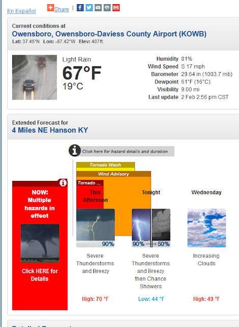
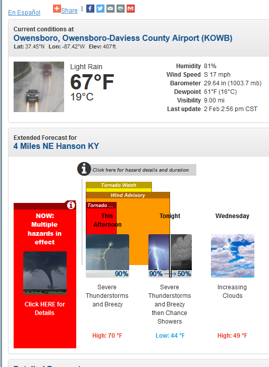
There is a tornado warning two counties due south of Evansville, Indiana in the town of Madisonville, Kentucky. The dew point in Madisonville is 61.
2/2/16 Update 4
A tornado was confrimed in Newton, Mississippi. The dew point there is 68.
The current dew point in Bloomington is 53.
Tornado watch areas are slowly shifting east for areas to our south.
The current dew point in Bloomington is 53.
Tornado watch areas are slowly shifting east for areas to our south.
2/2/16 Update 3.
The National Weather Service has issues a Tornado Watch for points south of here including western Kentucky, western Tennessee, and northern Mississippi. This makes sense. Check out the current dew points for selected cities as of 1:52pm today:
Bloomington 44
Evansville 54
Paducah 60
Memphis 65
Tupelo 64
Bloomington 44
Evansville 54
Paducah 60
Memphis 65
Tupelo 64

Tuesday 2/2/16
Thunderstorms tonight! Some of them may be strong or severe the farther south you go. Instability in the air aloft is going to be key. One of the criteria for tornadic activity is dew points above 60. In the winter time dew points above 50 can also count. The current dew point is 35 degrees. The higher the dew point temperature, the more moisture there is in the air.
Once we get through tonight there are clear skies ahead for the rest of the week. There will be a brief cool down Wednesday before warming up again. A high temperature of 50 degrees is possible by Sunday.
Cold air will return by next Thursday 2/11.

Once we get through tonight there are clear skies ahead for the rest of the week. There will be a brief cool down Wednesday before warming up again. A high temperature of 50 degrees is possible by Sunday.
Cold air will return by next Thursday 2/11.

Subscribe to:
Posts (Atom)