7/7/17 @2:30PM
The line is showing signs of weakening and breaking up in the middle. We'll see if it turns out to be true.
7/7/16 Round 2 of possible severe wx in Indiana.
Severe Thunderstorm Watches are posted for southern Illinois counties right now. The line of storms will continue to move off to the east. The storms should reach the Bloomington area in two pieces. The first wave between 4:30pm and 8:00pm and the second part between 4:00am and 6:00am on Friday morning. Temperature drop into the low 80's by Saturday.


7/6/16 @ 10:15AM
Lots of heavy rain and winds. Not letting up. Storm system is slow moving. "Bowing" occurring and marching towards Ohio River.
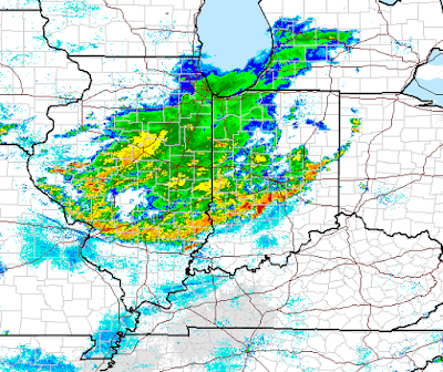
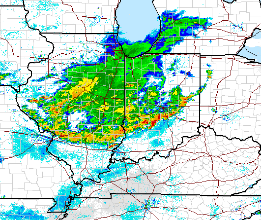
7/6/16 @10:00AM Heaving rains and winds in Bloomington right now.
The Ellettsville Library just lost power. Be careful out there. Traffic lights could be out in surrounding areas.
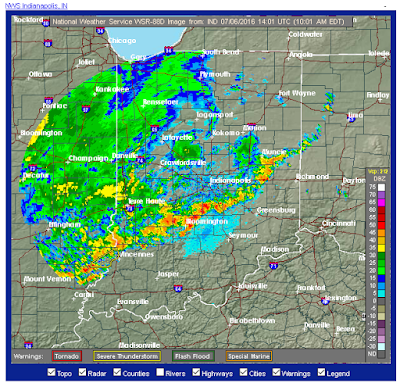 The temperature is 77 while the dewpoint is 72. Barometer is 29.9in.


A cool down is coming!
Are you sick of the high humidity and temperatures in 90's yet? Next week will be much better. There's a "High Ozone" alert for Monroe County Indiana today. If you have asthma or other medical respiratory conditions, you might want to stay inside with the air-conditioning on. Relief will arrive by Monday, June 27, 2016.


Subscribe to:
Posts (Atom)