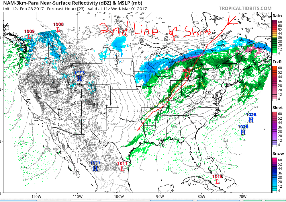
Active weather setting up for the next few days.

Strong and severe storms are likely in the Bloomington area tonight. There could also be some tornadoes with this system. This system is a lot like the last system that moved through on February 24th. The first line is disorganized and that is where our super cell and tornado threats will be focused; primarily in southern Indiana. The second line moves through much later on. First, let's look at the NWS storm prediction data for tornadoes:


Next, here is the NWS overall storm prediction for strong sever storms:


Here are some "possible" radar setups for the tornadoes: (see red circles)


Finally, here comes the second line of storms:


Be careful and stay safe. Now is the time to change the batteries in your all hazards weather radios and if you don't have one, you should purchase one. It could save your life!

Severe weather over for now.

The second line of storms experienced some deformation. We got lucky on this one but stay tuned for an early and active spring. A couple of snow flakes are possible in the next 36 hours.

First line of storms has moved through.

The second line; the main event, is on the Illinois-Indiana border and moving south eastward.


Small chances for flurries after the passage of the front Friday night.

The NWS (National Weather Service) is giving us 20% chance of rain/snow on Saturday and a 20% chance on Sunday night. After that, it's over.


Strong storms on tap for tomorrow, 2/24/17.

A line of storms associated with a cold front will develop over Illinois and swing through Indiana tomorrow evening from 8pm to 12am. Everyone should stay alert. The main concerns are for the areas highlighted in yellow.


Winter's last stand!

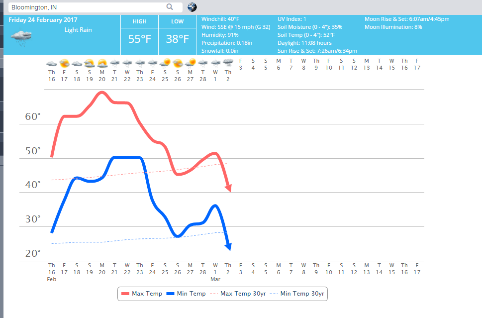
Temperatures will be near 30 degrees above normal for this weekend but don't let that fool you. Old man winter will stage a comeback during the February 25 - March 5, 2015 time frame. After that, the month of March looks to be warm. So, this is it #BOTS fans! This is the likely the last time you'll see any snow until the 2017-18 winter season.


Recurring Rossby Wave and February 23rd.

The Recurring Rossby Wave analysis chart has been hinting at a big drop on February 23rd since back in early January. It has been fairly consistent on this particular date so I'm inclined to trust it. If there's any chance of a late month winter storm, I would keep an eye out for February 23rd.

2/7/17 @11:45am

It's mostly cloudy in Bloomington with a light wind and a temperature of 60 degrees. There are some sprinkles and very light rain but that's about it. A chance of showers and thunderstorms remains throughout the day. Snow flurries are possible on Wednesday, 2/8 as temperature fall behind the approaching cold front. After that, we return to 60 degrees by Saturday. Here's NWS surface analysis for the next three days:


@ 9:55am 2/3/17

It will be cold today with a high of 31. Temperatures begin to warm up tomorrow from a high of 37 on Saturday to a high of high of 58 on Tuesday. Another shot of cold air arrives on Wednesday, February 8th and lasts until Saturday, February 11th. After that we warm up again. This has been the pattern all winter long.

Also, current radar indicates that there are snow showers moving toward our area. Given that the precipitation is so light and the that the air is so dry, I don' think the snow will reach the ground level but it is showing up on radar.


Is Winter over? No, but the pattern doesn't look favorable for any big snowstorms in the near term.