Indiana looks to be slightly wetter than normal with near normal to slightly above normal temperatures for the southern parts of Indiana.
http://www.noaa.gov/media-release/us-winter-outlook-noaa-forecasters-predict-cooler-wetter-north-and-warmer-drier-south

A cool down is coming in the middle of October.
Temperatures could be slightly below normal during the middle of October. The target dates would be between October 12 - 19. Say good bye to the 80's and maybe even the high 70's after this period.


From the NWS:
.LONG TERM /Friday through Monday/...
Issued at 340 AM EDT Tue Oct 3 2017

An active and unsettled weather pattern will continue through much
of the extended as the cold front remains draped across the region
into early next week.

The convective threat will be primarily focused over northern
portions of the forecast area on Friday and Friday night in closer
proximity to the boundary. Decent extended model agreement exists
on a sharp upper wave ejecting out of the northern Plains on
Friday and tracking into the Great Lakes Saturday while steadily
strengthening. The upper wave will help to generate a surface low
along the boundary which will rapidly intensify on Saturday as it
cuts across the Great Lakes. A trailing cold front will be drawn
through central Indiana Saturday afternoon and evening as a result
with the potential for stronger convection to accompany the
boundary.

Model consensus favoring the deepening low pressure lifting
north-northeast towards James Bay rapidly Saturday night with the
frontal boundary getting left behind over the Ohio Valley.
Confidence lowers from this point forward as several factors could
contribute to additional rain and convection impacting the region
into early next week. Some model agreement starting to show
regarding tropical development over the Gulf of Mexico this
weekend. The system is expected to lift north near or just east of
the Mississippi River by late Sunday and eventually get drawn
into the Tennessee and possibly Ohio Valleys by Monday as it
interacts with yet another wave kicking east into the region. The
remnant boundary could serve as a focus for additional showers and
thunderstorms with higher pops once again warranted for Sunday
night and Monday. The front will sweep the low lifting out of the
Gulf off to the east by early Tuesday.

Temperatures will remain largely above normal through the weekend
with highs ranging from the mid 70s to lower 80s. The departure of
the front just outside the 7 day will enable a strong Canadian
high pressure to expand across the Midwest. Trends support much
cooler weather across central Indiana by the middle of next week.
A La Nina Watch is in place for this coming winter.
The September ENSO forecast is out!! Forecasters think there is an approximately 55-60% chance of La Niña this fall and winter, so we’re hoisting a La Niña Watch. Read on to find out what’s behind this development!
https://www.climate.gov/news-features/blogs/enso/september-enso-update-la-ni%C3%B1a-watch
https://www.climate.gov/news-features/blogs/enso/september-enso-update-la-ni%C3%B1a-watch
A quick update for September 13, 2017.
The current conditions in Bloomington are cloudy with light drizzle. The streets are partially wet. The temperature is 62 degrees. There will be light rain off and on for the rest of the day. It warms up into the weekend with temperatures in the mid 80's.
Jose still seems on track to strike the east coast somewhere between North Carolina and Maine.
The Winter Storm Watch of the season has been post in Condon, Montana.
Jose still seems on track to strike the east coast somewhere between North Carolina and Maine.
The Winter Storm Watch of the season has been post in Condon, Montana.
URGENT - WINTER WEATHER MESSAGE
National Weather Service Missoula MT
203 PM MDT Tue Sep 12 2017

MTZ006-007-043-132015-
/O.NEW.KMSO.WS.A.0007.170915T0300Z-170915T1800Z/
203 PM MDT Tue Sep 12 2017

...WINTER STORM WATCH IN EFFECT FROM THURSDAY EVENING THROUGH
FRIDAY MORNING ABOVE 6000 FEET...

* Impacts/Timing: A dramatic change in the weather is on the way
  as a very cold and wet weather system drives the snow level down
  to near 6000 feet overnight Thursday into Friday morning along
  with temperatures plummeting 30 to 50 degrees colder compared
  to Tuesday (today). Slushy snow accumulations are expected on
  the mountainous terrain, trails and dirt roads which may
  negatively affect recreation or travel. Additionally, the
  transition from very cold rain to snow and the dramatic change
  to colder weather will heighten the risk of hypothermia to those
  who are not well equipped or prepared for early winter weather
  conditions.

* In addition, a mix of smoke and variable visibility throughout
  the higher terrain will abruptly change to low visibility and
  widespread terrain obscurations. Again, it must be emphasized,
  this is a HUGE change from the current warm summer recreational
  conditions.

* Snow accumulations: 6000 to 7000 feet: 1 to 3 inches. Above 7000
  feet: 3 to 6 inches are possible...especially over the highest
  peaks.

* Locations impacted include: Highway 93 Sula to Lost Trail
  Pass, Georgetown Lake, and MacDonald Pass
Jose to strike the eastern coast near New Jersey?
This is ten days away so there is not certainty on anything this far out.

Some very bizarre weather lately and more to come.
First I would like to send warm wishes and prayers for those who are trying to recover from the devastation of Hurricane Harvey.
Has anyone notices that Fall has arrived earlier than usual? It could be because of how dry the weather has been over the last month. Leaves are already on the ground and the leaves are changing colors here in Bloomington, Indiana.

Hopefully we will get some rain overnight. There's an 80% chance of thunderstorms tonight so that should help with the drought.
Currently it's 89 degrees with a with relatively low humidity at 42%. The good news is that once the cold front passes later tonight, the extended forecast is fabulous. For Wednesday, Thursday and Friday nights we will have low temperatures in the upper 40's. Can you believe that?

Another oddity is that the sun seems to burn a lot hotter than it used to. Maybe it's just me but the 3 O'clock sun above for the last three days burns my skin immediately. I'd say wear sunscreen between 2-4pm because that's when it seems the worst.
Next up is Hurricane Irma. The GFS has it on a direct path for southern Florida and then merging with a disturbance in the upper midwest creating a cool core of air over our location. Remember that this is nearly 10 -12 days out so a lot is subject to change.

Also, The Farmer's Almanac released it's Winter 2018 general prediction map. It looks like average cold and average snow but we shall see.

Lastly, the Lotus World Music and Arts Festival will be held in Bloomington Indiana from September 28 - October 21, 2017. Long range predictions from AccuWeather show it raining but that is so far away we might as well count on the opposite. I say sunshine and clear weather!

I hope you enjoy the rest of the week. Have a Happy Labour Day.
Has anyone notices that Fall has arrived earlier than usual? It could be because of how dry the weather has been over the last month. Leaves are already on the ground and the leaves are changing colors here in Bloomington, Indiana.

Hopefully we will get some rain overnight. There's an 80% chance of thunderstorms tonight so that should help with the drought.
Currently it's 89 degrees with a with relatively low humidity at 42%. The good news is that once the cold front passes later tonight, the extended forecast is fabulous. For Wednesday, Thursday and Friday nights we will have low temperatures in the upper 40's. Can you believe that?

Another oddity is that the sun seems to burn a lot hotter than it used to. Maybe it's just me but the 3 O'clock sun above for the last three days burns my skin immediately. I'd say wear sunscreen between 2-4pm because that's when it seems the worst.
Next up is Hurricane Irma. The GFS has it on a direct path for southern Florida and then merging with a disturbance in the upper midwest creating a cool core of air over our location. Remember that this is nearly 10 -12 days out so a lot is subject to change.

Also, The Farmer's Almanac released it's Winter 2018 general prediction map. It looks like average cold and average snow but we shall see.

Lastly, the Lotus World Music and Arts Festival will be held in Bloomington Indiana from September 28 - October 21, 2017. Long range predictions from AccuWeather show it raining but that is so far away we might as well count on the opposite. I say sunshine and clear weather!

I hope you enjoy the rest of the week. Have a Happy Labour Day.
Heat Advisory?
It's interesting that the NWS Indianapolis office has not issued a heat advisory for south central Indiana for Thursday and Friday. I would have expected that to happen by now. Nonetheless it will be hot and humid so remember to drink plenty of water.

https://en.wikipedia.org/wiki/Heat_advisory
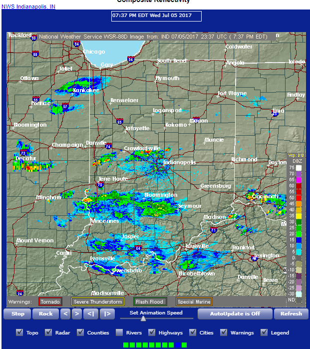
A severe thunderstorrm watch has been posted for Monroe County
SEVERE THUNDERSTORM WATCH 403 IS IN EFFECT UNTIL 900 PM EDT
FOR THE FOLLOWING LOCATIONS

INC005-007-011-013-015-021-023-031-035-045-055-057-059-063-065-
067-071-073-079-081-093-095-097-105-107-109-111-119-121-133-135-
139-145-157-159-165-167-171-080100-
/O.NEW.KWNS.SV.A.0403.170707T1745Z-170708T0100Z/

IN
.    INDIANA COUNTIES INCLUDED ARE

BARTHOLOMEW          BENTON              BOONE
BROWN                CARROLL             CLAY
CLINTON              DECATUR             DELAWARE
FOUNTAIN             GREENE              HAMILTON
HANCOCK              HENDRICKS           HENRY
HOWARD               JACKSON             JASPER
JENNINGS             JOHNSON             LAWRENCE
MADISON              MARION              MONROE
MONTGOMERY           MORGAN              NEWTON
OWEN                 PARKE               PUTNAM
RANDOLPH             RUSH                SHELBY
TIPPECANOE           TIPTON              VERMILLION
VIGO                 WARREN
Subscribe to:
Posts (Atom)