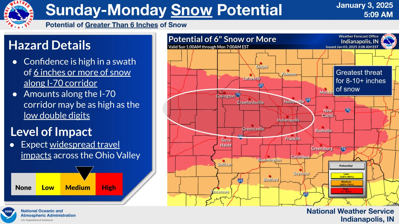
The storm system that is bringing big snow and ice to the south will also spread light snow into Indiana due to the merging of two storm systems over eastern Kentucky.
We seem to be in a pattern where we will see a storm system every weekend from now through January 25th.
The polar vortex will relax for three days before it reloads again. We should be above freezing from January 15 -17. After that, it gets cold again.
After that, the polar vortex eases again during the first week of February. There are hints that it will try and make a comeback by Valentines Day.
I don't like it but the National Weather Service has removed the "Windchill Advisory" and replaced it with a "Cold Weather Advisory". I think phrase "cold weather advisory" is fairly relative. I think the phrase "windchill advisory" automatically informs people to bundle up and wear extra layers and not to stay outside too long. That's just me though. In addition to that, the NWS has changed a lot of their definitions. If you would like to see all of them, you see them at:
https://www.weather.gov/lwx/warningsdefined
https://www.weather.gov/lwx/warningsdefined
Here is an example of the new "Cold Weather Advisory"
Cold Weather Advisory
URGENT - WEATHER MESSAGE
National Weather Service Louisville KY
1158 AM EST Wed Jan 8 2025

INZ076>079-083-084-089>092-KYZ023-025-030>037-040>043-049-090515-
/O.NEW.KLMK.CW.Y.0001.250109T0400Z-250109T1500Z/
Orange-Washington IN-Scott IN-Jefferson IN-Dubois-Crawford-Perry-
Harrison IN-Floyd-Clark IN-Hancock-Meade-Jefferson-Oldham-Trimble-
Henry-Shelby-Franklin-Scott KY-Harrison KY-Woodford-Fayette-
Bourbon-Nicholas-Clark KY-
Including the cities of Brandenburg, Corydon, Paris, Salem,
Cynthiana, Lexington, Georgetown, Louisville, New Castle,
Scottsburg, Tell City, Madison, Jasper, Hawesville, Winchester,
Paoli, La Grange, Frankfort, New Albany, Jeffersonville, English,
Bedford, Versailles, Lewisport, Milton, Shelbyville, and Carlisle
1158 AM EST Wed Jan 8 2025 /1058 AM CST Wed Jan 8 2025/

...COLD WEATHER ADVISORY IN EFFECT FROM 11 PM EST /10 PM CST/ THIS
EVENING TO 10 AM EST /9 AM CST/ THURSDAY...

* WHAT...Very cold wind chills or air temperatures as low as 5 below
  zero expected.

* WHERE...Portions of south central Indiana and east central, north
  central, and northwest Kentucky.

* WHEN...From 11 PM EST /10 PM CST/ this evening to 10 AM EST /9 AM
  CST/ Thursday.

* IMPACTS...Frostbite and hypothermia will occur if unprotected skin
  is exposed to these temperatures.

PRECAUTIONARY/PREPAREDNESS ACTIONS...

Use caution while traveling outside. Wear appropriate clothing, a
hat, and gloves.

Keep pets indoors as much as possible. Make sure outdoor animals
have a warm, dry shelter, food, and unfrozen water.