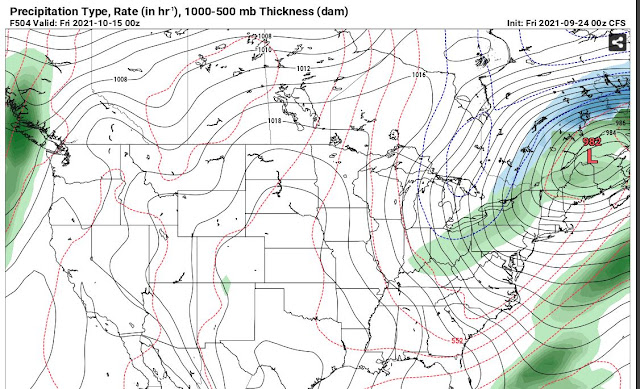
Fall is on the way and you will notice it later this week. Thursday night's low could reach 45 degrees. In the meantime, enjoy the rain today, tomorrow and Wednesday. Here's what the National Weather Service has to say, plus, check out the eye candy below.
Area Forecast Discussion
National Weather Service Indianapolis IN
725 AM EDT Mon Sep 20 2021

...Updated Aviation Discussion...

.Short Term...(Today through Tuesday night)
Issued at 314 AM EDT Mon Sep 20 2021

An area of strengthening isentropic lift moving through central
Indiana is bringing rain to the forecast area early this morning.
This initial area will continue to move north during the early
morning hours. A vort max will move through from mid to late morning
providing additional forcing that should keep shower coverage high.
A saturated column and tropical air mass will lead to efficient
precipitation production and higher rainfall rates. Forcing then
shifts northeast and could see a lull during the late
afternoon/evening hours and into the night. During the overnight
hours another shortwave will approach from the west ridging
northeast through the approaching longwave trough, and isentropic
lift will increase ahead of the approaching cold front during the
day on Tuesday. With the fetch of warm and humid air still streaming
north ahead of the cold front, again looking at a saturated column
with ample available moisture and efficient precipitation processes.
Forcing will be more significant with this approaching trough, and
between that and the moisture will need to monitor the potential for
heavy rainfall leading to flooding issues. Working against negative
impacts from this heavy rainfall, though is the fact the area has
been dry, with a decent soil moisture deficit in place as well and
low streamflow, and this (along with model inconsistency
mentioned below) is the reason behind no headlines at this time.

Models start to show significant variation in the pattern Tuesday
night after the front gets either east of the area, or perhaps gets
hung up over the eastern counties. Solutions differ in their
handling of the exit of the system and whether a secondary wave
forms that essentially stalls it out and retrogrades the upper wave
over the Great Lakes. Should that occur, chances for precipitation
will hang around for quite some time and a heavy rainfall threat may
continue into Wednesday. Some solutions move things along faster and
bring the heavy rain threat to an end by Tuesday evening. At this
time will carry some PoPs through the night Tuesday night, but keep
QPF amounts lighter during that timeframe.

Temperatures will be cooler today with the rain and cloud cover
expected throughout the day, but still in the middle 70s to lower
80s with warm advection. Temperatures start to fall a little Monday
night, but Tuesday with the flow head of the cold front should still
see highs in the middle 70s. After frontal passage there is some
uncertainty in how quickly temperatures will fall based on the
different solutions mentioned previously, so lower confidence on
those Tuesday night lows.

&&

.Long Term...(Wednesday through Sunday) Issued at 314 AM EDT Mon
Sep 20 2021

The long term period will start out much cooler with the cold front
having just exited to the east of the area, where it is then
expected to stall on Wednesday followed by a mid to upper level low
forming over the Ohio Valley Thursday. These will act to prolong
PoPs into the day Thursday, but with minimal instability expected,
central Indiana should just see some rain showers. There is some
discrepancy on where the low will form Thursday... most runs have
been suggesting it should form over the Ohio Valley, near central
Indiana, but a few runs show it forming further NE of the area
which would keep any associated precip out of the area for
Thursday. Will have to keep an eye on how things progress as we
get closer. Brief upper ridging paired with a surface high finally
moving into the area once the low exits to the NE, should usher
in dry weather for the end of the work week. Models are suggesting
that a weak upper wave could bring another chance for rain early
in the weekend but will then be followed by another upper ridge,
ending the period with dry weather.

The timing for any feature throughout the long term still lacks
consensus between models and even between runs as they differ on the
progression of the front Tuesday, when and how far east the front
will stall, and then where the low will form mid/late week. There is
however, high confidence in much cooler temperatures through the
period and the potential for rain, but confidence is lower on the
details and timing of much of the precipitation at this time.


