Strong and severe storms are likely in the Bloomington area tonight. There could also be some tornadoes with this system. This system is a lot like the last system that moved through on February 24th. The first line is disorganized and that is where our super cell and tornado threats will be focused; primarily in southern Indiana. The second line moves through much later on. First, let's look at the NWS storm prediction data for tornadoes:
Next, here is the NWS overall storm prediction for strong sever storms:
Here are some "possible" radar setups for the tornadoes: (see red circles)
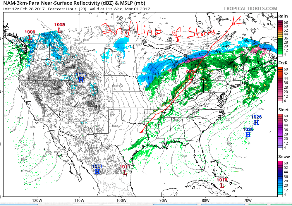
Finally, here comes the second line of storms:
Be careful and stay safe. Now is the time to change the batteries in your all hazards weather radios and if you don't have one, you should purchase one. It could save your life!


No comments:
Post a Comment