https://www.rd.com/article/twister-sequel/
The National Weather Service just issued it winter weather outlook for 2022-23.
The 30 second preview:
https://twitter.com/i/status/1583116174203944961
The full report:
https://www.noaa.gov/news-release/us-winter-outlook-warmer-drier-south-with-ongoing-la-nina
A slight warming trend before chaos next week
Temperatures will gradually warm up. Expect a high temperature of 77 on Sunday. That will feel great. Next week brings total chaos. Just about anything and everything is on the table. Here are the players on the field: A cold front moving in, a storm in the plains and tropical storm coming in off the coast. Some computer models are hinting at the idea that they all want to meet up somewhere in the Midwest.


#BOTS fans!
There's a tiny chance to see snow flurries tomorrow.

Long Term...(Tuesday through Sunday)
Issued at 300 AM EDT Mon Oct 17 2022

* Widespread freeze conditions nearly certain multiple mornings
  early-mid week, particularly Tuesday Night which would officially
  end growing season

Model guidance remains consistent on the overall pattern for the
week with a very large and anomalously deep closed low roughly over
the Great Lakes early in the week before it steadily pulls
north/northeastward toward next weekend.

Models have been trending towards slightly better chances for
precipitation tonight which could continue into Tuesday over the far
north counties as the fetch from the backside of the low pulls down
lake effect moisture into the area. Given the below freezing
temperatures in the forecast for early Tuesday morning, the long
term could start out with some light snow or a rain/snow mix. The
ground should still be warm enough that there wouldn`t be more
than light accumulations on grass from overnight.

The long term will start out much colder than normal behind the
passage of a cold front with highs for the first few days staying in
the 40s to near 50 and overnight lows near to below freezing.
Tuesday night will see the best chance for widespread freezing
temperatures with a good chance of a hard freeze that night. This
should allow for the end of the growing season if the area does not
see that tonight. Thus, will not be issuing any further
frost/freeze headlines at this time.

For the latter half of the work week and into the weekend, the upper
low will slowly exit to the NE allowing for broad ridging to move
in. At the surface, a return to SW flow will also lead to a warming
trend for the end of the week. By the weekend temperatures are
expected to reach above normal with highs getting into the lower
70s.

Models are then showing, with great variability, another trough
approaching the area at the tail end of the period. This could bring
a better chance of much needed precipitation to central Indiana but
given the uncertainties, confidence is low for now.
It's going to be cold next week
Expect freeze warnings for Monday and Tuesday. Northern Indiana will get some snow on Tuesday.
#BOTS!

#BOTS!
Heads-up if you use weather apps on your phone or tablet. The Thursday night temperature forecast is likely too warm. We have a chance to hit the freezing mark Thursday night (10/13), Sunday night (10/16) and Monday night (10/17).
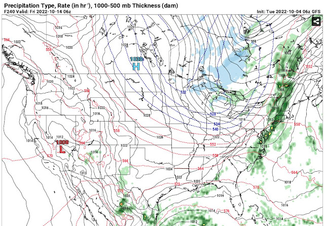
Believe it or not, snow is showing up the long range CFS model. Of course this is not to be trusted this far out but it is nice to see. #BOTS fans!

The image above if for November 11, 2022. Out first snow flurries in this area usually occur around November 15th so this isn't an extreme idea. We've already had frost in early October so it's possible.
Frost and freeze warnings are already in place for this weekend.


National Weather Service Indianapolis IN
300 PM EDT Fri Oct 7 2022

.Short Term...(This evening through Saturday night)
Issued at 257 PM EDT Fri Oct 7 2022

...FROST ADVISORY TONIGHT...

* Frost Likely and isolated Freezing conditions Tonight
* Sunny and pleasant Saturday

Surface analysis early this afternoon shows strong and cold high
pressure over the Dakotas, building south. This large high was
extending its influence well east across the Great lakes and into
the Ohio Valley. Cool north winds were in place across Indiana.
GOES16 shows lake clouds steaming off of Lake Michigan, but most of
these clouds were failing to reach Central Indiana. Aloft, water
vapor imagery showed a broad trough across the eastern 2/3rds of the
United States...with some high clouds passing across Illinois and
Indiana within the flow. Dew points across much of Central Indiana
have fallen to the middle 30s, with lower 30s found upstream.

Tonight...

Models show prominent NW flow in place aloft overnight with
negligible forcing dynamics in place. Surface high pressure over the
northern plains states is expected to sag southeast and a ridge axis
is shown to extend east across Central Indiana. Time heights and
forecast soundings overnight continue to indicate a dry column with
subsidence. As heating is lost this evening and as the ridge axis
builds, winds will subside leading to ideal radiational cooling
conditions with clear skies and light to calm winds. Surface dew
points across the area are still above 32 for the most part but
additional cold air advection is expected overnight. Currently the
25 percentile NBM temps suggest lows near 32, meaning there are many
more scenarios where lows do not fall below 32. Given our current
dew points, frost appears to be a slam dunk, but freezing temps will
more likely be the exception rather than the rule. Thus will trend
overnight lows to mainly the middle 30s, probably with a frost
advisory in play rather than a Freeze warning.

Saturday and Saturday night...

Northwest flow is expected to persist aloft on Saturday and Saturday
night, again with negligible forcing dynamics in place. Forecast
soundings and Time heights again show a dry column with unreachable
convective temperatures on Saturday with a mid level inversion in
place aloft. Meanwhile at the surface, the strong high pressure
system is expected to sink southward and become more elongated
stretching from Kansas toward eastern TN. This will set up a
westerly flow across Indiana and also prevent any lake cloud from
arriving in our forecast area. Thus we will expect a mostly sunny
Saturday and a mostly clear Saturday night under influence of the
surface high. Models suggest the beginning of warm air advection
on Saturday and Saturday night as the core of cold air with this
past system drifts east of Indiana. 850mb temps are shown to rise
from below 0C to near 2C by 12Z Sunday. Thus will still stick
close to highs in upper 50s and mid to upper 30s on Saturday
Night. Again, frost looks to be in play on Saturday Night.

&&

.Long Term...(Sunday through Friday)
Issued at 257 PM EDT Fri Oct 7 2022

* Dry conditions and warming trend through mid next week
* Next chance for precipitation arrives Wednesday
* Cool and dry late week

Sunday through Monday

Warmer weather returns Sunday as surface high pressure moves east
and southwest flow returns. Aloft, guidance suggests troughing
remains through Monday few upper level impulses tracking across
northern IN Sunday through Monday morning. Precipitation is not
expected with these features as moisture return lags due to dry air
across much of the region. However, mid-high level clouds will
increase late Sunday which could limit overnight lows. Breezy
conditions are expected during the day with forecast soundings
showing a well-mixed boundary layer with the potential for 20-25mph
wind gusts.

Monday through Late Next Week...

Mid-high clouds should clear out Monday as the aforementioned upper
level feature departs. Upper ridging will then build in and help to
continue the warming trend as heights increase aloft. In addition,
an approaching cold front midweek will lead to increasing southwest
flow. Both GFS and EC ensembles show above average 850mb temperature
anomalies first half of the week, supporting highs in the mid to
upper 70s. Quiet weather is expected through Tuesday with synoptic
subsidence from ridging aloft and a dominant surface high across the
Mid-atlantic.

Rain chances increase Wednesday through early Thursday
as the previously mentioned cold front moves through. Not the
greatest confidence in widespread significant precipitation yet
given the continued dry pattern and surface ridging possibly
limiting moisture advection. Although, recent ensemble guidance
shows a slightly stronger 850mb jet with deeper moisture across the
area. With the jet stream diving so far to the south, there may be
enough lift and upper level support along the front for light
precipitation to develop, but this will be something to watch over
the coming days. Keeping chance wording for PoP during this
timeframe with the best chance for rain Wednesday night through
Thursday morning. Cooler and drier air will filter in behind the
front late week. The coldest air is not expected to arrive until
Friday as the trough axis moves east.
The Dick Frymire winter forecast!
The people of the great state of Kentucky have a local legend that has been predicting the winter weather for years. Dick Frymire passed away in 2013 but his family still continues the tradition.
Here is the forecast for the upcoming winter:

Here is the National Weather Service outlook for December 2022 - February 2023:


Updates and news you can use.
Everyone in Bloomington will see frost Friday night and Saturday night since the temperature will 34 degrees both nights.


October is our second severe weather season. It is possible to see severe weather and tornadoes because of the clash of cold and warm air masses just like in the spring.

Our first freeze is possible between October 14 and October 19.

#BOTS! Flurries on October 19th?

Here's what the NWS thinks:
Forecast Update...
Issued at 641 AM EDT Tue Oct 4 2022

Minor changes to the forecast this morning. Refined the mention of
patchy fog across our northeastern counties based upon recent
observations and satellite trends. Nudged temperatures north of I-70
down a degree or two, again based upon recent observational trends.
High pressure is currently overhead, and winds have generally
decreased to less than 5kts during the course of the night. A few
locations have even gone calm for multiple hours, and these have
typically been the cooler spots with frost and fog. Given the
expectation of clear skies with light winds through morning, the
continued development of patchy frost and fog is anticipated until
shortly after sunrise.

&&

.Short Term...(Today and tonight)
Issued at 252 AM EDT Tue Oct 4 2022

Through Sunrise

High pressure is currently building into the region, and light
northeasterly winds are diminishing. Some weak cold air advection
throughout the day yesterday has allowed for cooler conditions
compared to the prior overnight period. Many rural stations are
reporting temperatures in the middle 30s as of 06Z. Will carry the
mention of frost for much of the CWA and maintain the Special
Weather Statement. Urban areas

With excellent radiational cooling potential, some patchy ground fog
is possible by morning. Terra Haute recently had a brief period of
visibility under 2 miles. Low-level moisture is quite limited,
however, and widespread fog is not expected. The main forecast
challenge through morning will be the frost coverage.

Today

Any frost or ground fog will dissipate quickly after sunrise once
temperatures begin to rise. Efficient boundary layer mixing may once
again occur this afternoon, and surface dew points may drop to under
32F. Will keep dew points under NBM guidance this afternoon. High
temperatures are expected to be seasonable, around 70, and winds
will remain very light. A few high clouds may be noticeable to our
east early, but these should diminish throughout the day.

Tonight

The center of the surface high will be directly overhead by tonight.
Some air mass modification and the cessation of weak cold air
advection will lead to slightly warmer overnight lows compared to
this morning. While a few instances of frost may occur, most
locations are not expected to be cold enough to support frost. Some
patchy ground fog is possible, but once again not expected to be
widespread. Most likely places for patchy fog would be low points in
the local terrain and farmland with enhanced surface moisture from
evapotranspiration.

&&

.Long Term...(Wednesday through Monday)
Issued at 252 AM EDT Tue Oct 4 2022

* Frost likely with potential freezing temperatures this weekend
* Very low chance for rain around Thursday

Wednesday...

Upper ridging and surface high pressure will continue the dry
conditions. Sunshine and dry air will allow temperatures to peak
above normal in the lower to middle 70s. Afternoon humidity will be
low once again, but with high pressure nearby, winds will be light.
This will help mitigate potential fire concerns.

Thursday into Friday...

A weak upper wave will move through on Thursday, with an accompanying
weak surface trough. Moisture will be limited with the Gulf cut off.
This means little chance of rain, and the models continue to hint at
little if any QPF. Will keep some slight chance PoPs across the
northern forecast area Thursday afternoon. Above normal temperatures
will continue with highs in the mid to upper 70s.

Thursday night, a cold front with significantly colder air behind it
will move through. However, best forcing will be north of the area
closer to an upper low across southern Canada. The upper jet will be
over the area, putting the left exit region north of central
Indiana. This will limit forcing here as well. Moisture will
continue to be limited as well. Thus, odds of any measurable rain
are low. Will continue a dry forecast Thursday night.

As colder air flows in on Friday, some lake enhanced showers may
move into northern Indiana. These should remain north of central
Indiana, so went dry on Friday as well. Thanks to strong cold
advection, highs on Friday will only be in the 50s to around 60.

Saturday and Sunday...

Surface high pressure will move through during the weekend, keeping
the area dry and cool. Highs on Saturday will be in the 50s, with
some southwest flow on the west side of high pressure bringing 60s
for highs on Sunday.

Clearing skies and weakening winds will allow temperatures to dip
into the lower to middle 30s by sunrise Saturday. Frost will become
likely many areas, with the potential for below freezing
temperatures, especially in favored cold spots. Similar conditions
will exit early Sunday morning, but a hint of a southwest wind
should keep temperatures above freezing. Frost will be possible
again though.

Columbus Day...

Upper flow will become zonal or perhaps southwesterly depending on
how an upper low develops across the northern USA. This will allow
for warmer temperatures. At the moment, forcing from the approaching
system looks to remain far enough west to go with a dry forecast.
Subscribe to:
Posts (Atom)