
#BOTS fans!
Check it out! A large amount of heavy wet snow tomorrow afternoon. Looks like about 3-4 inches before it ends.

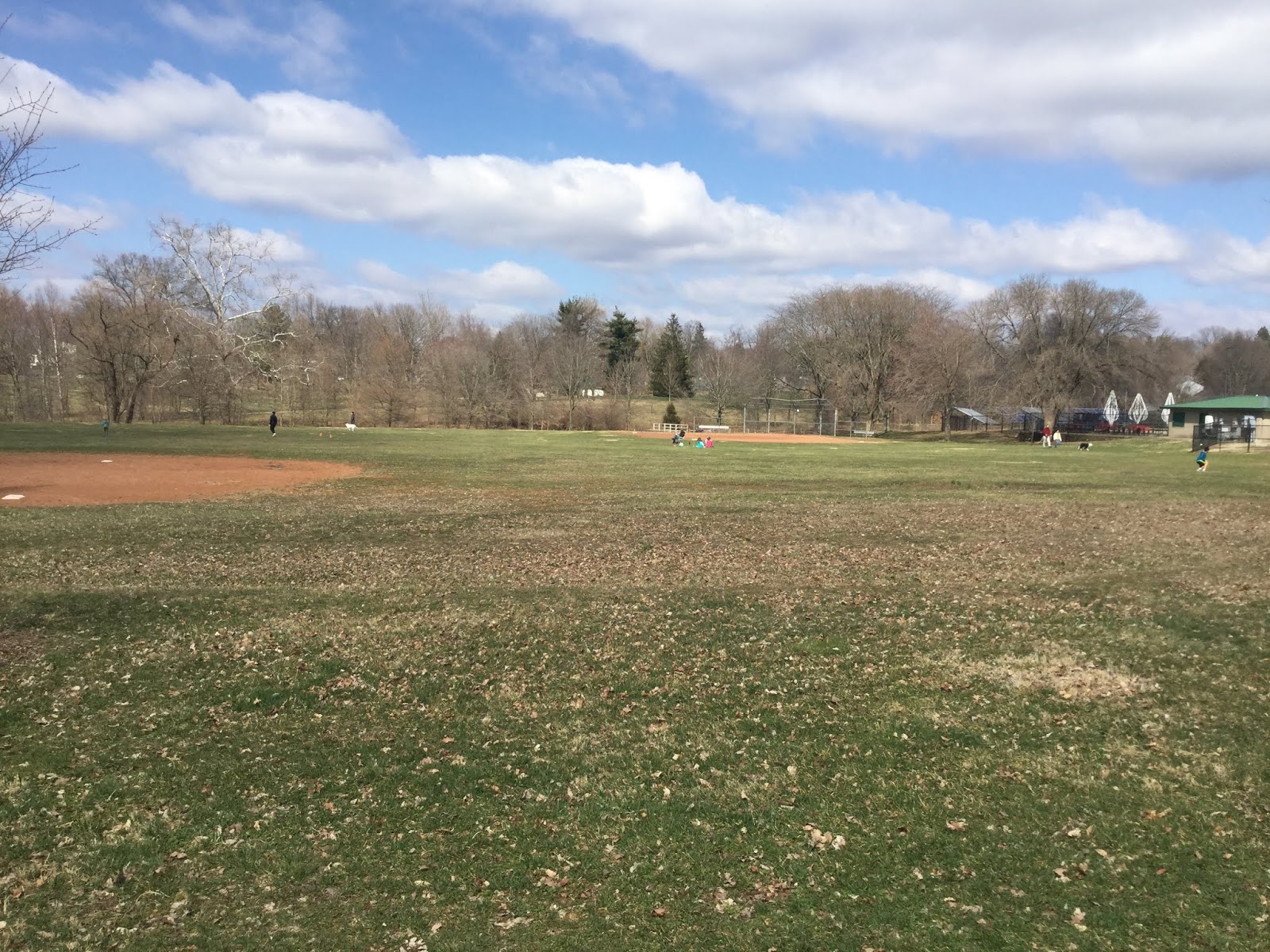
Ahhh... Spring in Bloomington Indiana
A slightly cooler start to the week but that's okay. We'll have sunshine all week long. Let's hope for more days like this: (unless you have allergies)


Rain is coming soon.
We had a couple of great days this week but that is coming to an end. Rain starts this evening and lasts until Monday morning. I know this is going to be tough on people who want to get outside but please stay inside. Here's the latest analysis from the NWS:
.SYNOPSIS...
Issued at 258 PM EDT Thu Mar 26 2020

A front will meander across the area into Saturday before being
finally swept east by a low pressure system on Sunday. This setup
will bring showers and thunderstorms to the area at times, with
heavy rain and perhaps some strong storms possible. Another low
pressure system could bring more rain next week. For the most
part, temperatures will be near normal to above normal.

&&

.NEAR TERM...(Rest of This Afternoon through Friday)
Issued at 258 PM EDT Thu Mar 26 2020

Areas of showers and a few thunderstorms continue to develop this
afternoon, mainly focusing on the far north and far south parts of
the area. Expect more precipitation to develop along the northern
forecast area with an upper wave moving through. Will go high
PoPs there into this evening. For most of the south, went chance
or lower PoPs after this first round currently there moves
through.

PoPs will then diminish from north to south tonight as a front
slides south through the area. However, some increase in PoPs will
occur late tonight as another upper wave approaches. Will keep PoPs
in the chance or lower category though.

On Friday, the front will try to work north. Various impulses will
move in the upper flow, and these will interact with the front to
produce some showers and a few thunderstorms. However, confidence is
low on timing and location of better forcing. Thus, kept PoPs in the
chance category for now during the day most areas. If details become
clearer, then PoPs may be upped where needed to give a better idea
of timing.

Storms this afternoon have produced some hail, and if a storm gets
tall enough, wouldn`t be surprised to see an isolated severe hail
report. This agrees with the SPC`s Marginal outlook tonight through
Friday.

NBM looks too warm tonight with some cooler air sneaking in behind
the front. Went closer to a blend of raw model data. NBM could be a
little warm for highs Friday as well, depending on how fast the
front moves north.

&&

.SHORT TERM /Friday Night through Sunday/...
Issued at 351 PM EDT Thu Mar 26 2020

Warm and wet weather is expected during the bulk of the short term
period as a strong low pressure system moves into the Great Lakes
by Sunday. Widespread showers and thunderstorms can be expected at
times from Friday night into Saturday evening, with chances
rapidly waning late Saturday night into Sunday as the cold front
passes. There will be a low but non zero threat for severe storms
Saturday into Saturday evening, with isolated large hail and
damaging winds the primary threats, particularly with a low level
jet likely to approach 50-60KT.

A strong pressure gradient and steep low level lapse rates aside
from thunderstorms will produce strong and gusty prevailing winds
as well, particularly Saturday afternoon into Sunday evening,
with the strongest winds expected Sunday. Sustained winds Sunday
of 15-25 MPH with widespread gusts of 30-40 MPH will be common,
with a few gusts in excess of 40 MPH possible. This will
particularly pose a threat to any temporary outdoor facilities set
up or high profile vehicles driving on north/south oriented
roadways.

&&

.LONG TERM /Sunday Night through Thursday/...
Issued at 351 PM EDT Thu Mar 26 2020

The long term period looks milder, with temperatures near normal.
After a brief break from precipitation earlier in the week, a
closed low will move through the region Tuesday into Wednesday,
meriting chances for showers, although thunder does not appear
particularly likely at this time.

Blended initialization handled this period well and required only
minor adjustments.

&&

.AVIATION (Discussion for the 261800Z TAF Issuance)...
Issued at 1258 PM EDT Thu Mar 26 2020

Conditions are expected to deteriorate to MVFR by 00Z and then
remain there for much of the rest of the period.

Most of the current showers and thunderstorms to the west look to
miss the TAF sites early on, but expect convection to increase in
coverage during the afternoon, especially for KLAF and KIND. Showers
will continue into the evening before diminishing in coverage.

Can`t rule out a thunderstorm at any TAF site into this evening, but
expected coverage is too low to mention.

A front will sink south through the area into this evening, so quick
wind shifts will occur as it passes.
In case you haven't been outside yet,
there's been a rain & sleet mix going on since about 11:00AM. It won't amount to much at all but I thought I would mention it.
The freezing line aloft is meandering between south of Indianapolis and north of Bloomington.

The freezing line aloft is meandering between south of Indianapolis and north of Bloomington.

Kirkwood Avenue in Bloomington Indiana is a ghost town.
It's 37 degrees, cold, windy, raw and gray. It's not the perfect day to be out and about and then throw in the closures due to COVID-19 and you get images like this:


What would normally be the busiest street in Bloomington is all empty except for Soma.


What would normally be the busiest street in Bloomington is all empty except for Soma.

This is what happens when you get too excited about the weather.
You start making too many funny mistakes like this:
"Wind gusts or small hair most likely risk..."


"Wind gusts or small hair most likely risk..."

"Wind gusts of small hair most likely risk..."

Did you hear that?
That was a rumble of thunder. Our second line of storms is moving through now. The new data coming in suggests that our severe threat will not be as bad as we expected in the Bloomington area. Our far southern counties have had their Tornado Watches extended until 4:00AM. Our main concern now will be flooding. Here the current radar map:


Triage
tri·age: (noun) [in medical use] the assignment of degrees of urgency to wounds or illnesses to decide the order of treatment of a large number of patients or casualties.
Severe weather will ramp up after 7:00PM this evening. There's a small chance for tornadoes and we are currently under a Flood Watch. If you add to this the COVID-19 recommendations, you see that we have a lot to plan for in the next 24 hours. How do you practice “Social distancing” when tornado procedures require everyone to hunker down in close quarters in the safest place? If a business is open, but, closed to the public due to the coronavirus, should they open temporarily as a safe place for people caught in flooding waters or tornadoes? If people are trapped in flooding waters or have been injured by damaging winds, how does this affect the response to their treatment? Does it take away necessary resources from people fighting to stop the coronavirus? There are a lot of questions here that I don't have the answers to so I would recommend staying home. Just stay inside. Don't go out. If you happen to hear the tornado sirens, go to your basement or safe place. If your basement or safe place is not big enough for your family to practice “social distancing” then do what you think is best. Triage. Take care of the most important emergency first and deal with the others later. Above all, stay safe.

Here is the latest analysis from the National Weather Service office in Indianapolis: (sorry that they use some kind of a weird text font, I can never figure it out):
.NEAR TERM /Today and Tonight/...

Issued at 353 AM EDT Thu Mar 19 2020

Lingering drizzle and some patchy fog is left over the lower
Great Lakes region early this morning in the wake of an upper-
level shortwave. Currently, a weak warm front lies across central
Indiana with a subtle temperature gradient. Temperatures overnight
range from the low 40s to the north and the mid 50s towards the
south.

Precipitation will come in two rounds today. A mesoscale convective
complex currently over Oklahoma, will progress northeastward
ahead of the aforementioned trough attributable to a moderated
low-level jet. This will bring rain with a few embedded
thunderstorms to the region this morning. Dewpoints behind this
complex have been in the low 60s throughout the day yesterday, and
model guidance has supported this trend to continue today. The
next round of precipitation will be primarily due to a semi-
organized low pressure system currently situated over the western
Plains. A secondary trough over southern Canada will also play a
role in the evolution of this system. Convective devlopment is
likely with this second round of precipitation.

Upper-air analysis depicts this low pressure system as relatively
stacked throughout most levels. This will impede cyclogenesis and
elongate the surface trough throughout the day. The previously
mentioned secondary trough over Canada will aid in lowering
heights over the northern Great Lakes, producing a closed low at
850mb. This will play a major role in enhancing the low-level jet
over Indiana this evening and overnight. Forcing at 500mb and
above will be fairly weak with this event in contribution to the
sub-tropical jet well west of Indiana during most of the event.
This will limit upper- level diffluence and progression of the
surface trough.

Cloud cover looks to remain throughout the day and will hinder
destabilization this afternoon. Although, dew points in the low
60s along with moderate mid-level lapse rates will provide enough
instability to promote convective development through the evening
and overnight. Any breaks in the cloud cover could increase
convective activity later in the evening. Wind shear will be ample
throughout the day and overnight to support updraft development
and multicell thunderstorms.

There is a potential for severe weather within this second event.
Adequate directional shear this evening supported by 10-15kt SSW
winds at the surface and SW 45-55kt winds between 850 and 700mb
will be enough to produce mesocyclones within convective cells.
The limiting factor will be the lack of sufficient lapse rates in
the low-levels, limiting updraft strength and therefor
thunderstorm longevity. CAPE values between 500 and 800 J/kg are
possible, but values exceeding 1000 J/kg look to be limited to
areas west and south of central Indiana. Continued monitoring of
the environmental conditions after the passage of this morning`s
MCC will be essential for better understanding of this evening
and tonight`s severe potential. Instability prognoses amongst
models various and will impact the extent of tonight`s severity.
For now, winds greater than 60 mph, with isolated hail and a few
tornadoes are possible. Greatest threat for severe weather will be
between 22Z and 08Z.

&&

.SHORT TERM /Friday through Saturday Night/...

Issued at 353 AM EDT Thu Mar 19 2020

There is a slight chance of lingering showers over central Indiana
to start the day Friday. Greater chances for precipitation exist in
our SE counties, as Thursdays convection and a sudo dry-line
progresses through. Once the cold front passes through, all rain
should come to a halt for the rest of the short term as high
pressure builds into the region.

Temperatures Friday morning will remain warm prior to the cold front
passage. Morning highs near 60 are possible with temperatures
dropping into the low 40s by Friday evening. Temperatures will
remain cool through Saturday in the with highs near 40.

&&

.LONG TERM /Sunday through Thursday/...

Issued at 323 PM EDT Thu Mar 19 2020

The models are showing that a messy pattern is in play through
the long term with several waves and chances of precipitation for
most of the period. Confidence is low for Sunday and Sunday night
as dry easterly air may limit moisture in the area and brief
ridging is expected to move in late Sunday night through Monday.
But with lower temperatures at the start of the period, snow could
mix in with rain at times. By Monday night, another wave is
projected to bring in more chances of precip followed by several
more waves through Thursday. Confidence on the exact timing of
rain is still somewhat low, but further detail should become
clearer in the coming days. The temperatures will be trending
upwards throughout the week. Accepted guidance given decent
agreement among the long range models.


&&

.AVIATION /Discussion for the 191800Z TAFS/...
Issued at 1235 PM EDT Thu Mar 19 2020

Initial band of warm advection rain/embedded lightning strikes
expected to affect the terminals through about 192100Z, according
to short term model data. This may result in precipitation
becoming more scattered in nature later this afternoon and
evening. Widespread IFR/LIFR ceilings/visibilities may tend to
improve from the south later this afternoon and evening, with the
passage of the warm front.

Model data suggest another area of organized lift may move over
the terminals after about 200400Z. This may result in another
enhanced threat for rain/thunderstorms after that time.

Surface winds this afternoon 130-160 degrees at 9-13 kts are
expected to gradual veer to 190-210 degrees by late evening.
Occasional surface gusts in excess of 20 kts should become more
frequent by this evening, as a 55-65 kt low level jet moves
overhead. Threat for low level wind shear will also increase this
evening, given the strength of the low level jet.


&&

.IND WATCHES/WARNINGS/ADVISORIES...
Flash Flood Watch through Friday morning for INZ060>065-067>072.
Strong storms are possible for Thursday March 19, 2020.
Well, Spring has sprung. Tomorrow is the official start to Spring. Be sure to check your smoke-alarm batteries and turn on your weather radio to monitor sever weather alerts.
We have a chance for some strong storms around the 1:00PM hour tomorrow.

A second line of storms forms overnight into Friday morning.

After that maybe we'll see a few snow flurries. Won't that be exciting?

We have a chance for some strong storms around the 1:00PM hour tomorrow.

A second line of storms forms overnight into Friday morning.

After that maybe we'll see a few snow flurries. Won't that be exciting?

A great day in Bloomington, Indiana: Corona-virus edition.
I hope you got a chance to go out and walk around or enjoy the park today. It's just lovely outside. The barometric pressure is "30.3". Rain returns tomorrow through Friday morning.

Some day it will be 85 degrees and the corona-virus will be dead and the pool will be open.


I haven't checked the markets today but I'm guessing the price of gold and silver are up since people are using metal detectors in the park.


The Clover Leaf is doing carry-out!


Some day it will be 85 degrees and the corona-virus will be dead and the pool will be open.


Walking in the park! (Alone?) This is a safe activity where you can be "Socially distant" and still be around others.


I haven't checked the markets today but I'm guessing the price of gold and silver are up since people are using metal detectors in the park.


The Clover Leaf is doing carry-out!

Rain is coming.
It's going to rain on Wednesday, Thursday and Friday. Here's the latest from the NWS:
.SHORT TERM /Wednesday through Thursday Night/...

Issued at 342 AM EDT Tue Mar 17 2020

Precipitation... A small, but well organized shortwave will progress
through the Midwest on Wednesday. Given a deep column of warm gulf
moisture and moderate isentropic lift, extended periods of rain are
likely throughout the afternoon and evening. Continued vigorous warm
air advection will prolong the rain threat overnight Wednesday, even
with the lack of significant upper-level support. Scattered showers
will remain throughout the morning on Thursday, but extend should
diminish associated with a weakened low-level jet. A more
amplified trough and low pressure system will approach Indiana
Thursday evening, where precipitation chances will once again
increase. Rain, heavy at times, will be prominent throughout the
night. Over the two day stretch, up to 2 inches is possible, with
locally higher amounts.

Thunderstorms... Convection will be limited on Wednesday due to a
strong surface based inversion beneath a robust stream of WAA. Some
embedded thunder is possible, but extent should be limited.
Thunderstorm probabilities will increase Thursday evening as
increased surface heating and steeper mid-level lapse rates will
set up over the region. Current model ensembles depict CAPE below
1000 J/kg over most of central Indiana. However, this should be
adequate for convection provided with surface dewpoints in the low
60s, and a minimal CAP. Morning rainfall and cloud cover could
restrict convective develop so Chc probability for thunder was
kept. The possibility for severe thunderstorms Thursday night is
limited but does exist as the low-level jet increases and
provides a better zone of optimal wind shear. The lack of a
significant surface cyclone and diurnal cooling will be the most
notable limiting factors. Mesoscale influences, will have a large
impact on the extent and severity of thunderstorms Thursday
night, and will need to be monitored in the coming days. For now,
severe consideration is left out of the forecast given the low
confidence.

Temps... Temps will rise throughout the short term as southwest flow
pushes a warm, moist airmass over the Midwest. Prolonged cloud cover
and rainfall during peak diurnal warming will damper high
temperatures for Wednesday. Expect highs to hover around 60. Robust
WAA overnight Wednesday will limit diurnal cooling and lay the
foundation for a rise in temperatures Thursday. Specific highs will
depend on the extend of rain and cloud cover in the afternoon, but
general highs in the upper 60s are likely with some areas
exceeding 70.

&&

.LONG TERM /Friday through Monday Night/...

Issued at 307 AM EDT Tue Mar 17 2020

ECMWF suggests a strong cold front quickly crossing Central
Indiana on Friday morning. Thus will continue to carry at least a
low chance for morning pops ahead of the front given the change of
air mass. Look for falling temperatures through the course of the
day in the wake of the front.

Cooler High pressure is then depicted to be pushing across the
Great Lakes through Sunday...resulting dry and cooler weather for
the weekend.

By Monday and and Monday night the surface high is depicted to
push east of Indiana as the upper flow shows mainly zonal flow
with weak forcing present. THus with a more southerly and warmer
surface flow in play...low chances pops have been used on Monday
but confidence remains very low for now.
Spring weather starts on March 16.
We will begin to see high temperatures in the mid 50's to mid 60's for at least the next two weeks. Enjoy. Stay healthy.
Mimi #bots fans!
.SHORT TERM /Saturday through MOnday|/...
Issued at 401 PM EDT Fri Mar 13 2020

Forecast challenges focus on precip chances and type on Saturday as
an overrunning precip setup develops with a frontal boundary south
of the region across the Tennessee Valley.

An upper low that was located across the Four Corners region this
morning will get absorbed into the quasi-zonal flow aloft that will
develop Saturday with the remnant upper wave tracking across the
region late day Saturday in tandem with a surface wave riding along
the frontal boundary across the Tennessee Valley. This will result
in an overrunning precipitation event for Saturday into Saturday
evening as a low level jet noses into the lower Ohio Valley. The
presence of the surface high to the northeast of the area will
maintain a dry cool flow across all of central Indiana with the
potential for rain to mix with snow in some areas through the day
and potential for snow to become the primary precip type at times.
The best threat to see snow will be from the morning into the mid
afternoon...with rain likely being more predominant later in the day
as the boundary layer warms.

Model guidance continues to overestimate potential snowfall amounts
on Saturday due to a variety of reasons. Think models are having
trouble capturing the impact that will come from surface and ground
temps that will remain above freezing. With precip rates not
anticipated to be very strong...any snow that mixes in with rain or
falls solo will likely melt to some degree on contact through the
day. With poor snow to liquid ratios to boot...am not anticipating
any more than an inch in spots and expect that might be overdone.
Not expecting any impacts to travelers as roads will be fine and any
whitening will be confined primarily to elevated surfaces. More than
anything...any snow that falls will serve as a reminder that winter
has not quite left yet.

Precip will end Saturday evening as the upper wave and surface low
shift off to the east. High pressure will then build into the region
for Sunday and Monday with dry weather and seasonable conditions.
Expect mainly clear skies through MOnday morning with clouds
increasing later in the day in advance of a frontal boundary that
will move into the region late Monday night into Tuesday.

Temps...nudged highs closer to the cooler end of the guidance
envelope Saturday with the precip and clouds. Should see upper 30s
and lower 40s most areas. Temperatures will gradually warm back into
the 50s by Monday with lows in the upper 20s and lower 30s. An
overall model blend will work well from Saturday night through
Monday.
This is a little off topic.
The coronavirus has pretty much shut Bloomington down. Please be safe and practice all the proper guidelines for protecting yourself as recommended by the CDC. Also, pay close attention to your local and state health departments.
Here's what the CDC says:
https://www.cdc.gov/coronavirus/2019-ncov/hcp/guidance-prevent-spread.html
According to the Health Department of the State of Indiana, we have 12 confirmed cases.
https://www.in.gov/coronavirus/
According to the Monroe County Health Department, we have 0 confirmed cases.
https://www.co.monroe.in.us/department/?structureid=12
If you're going to Kroger, prepare to be disappointed. Here is what I saw at the South Walnut St. location:


Maybe this sounds gross and I'm sorry about that but, how are baby wipes any different from sanitizing wipes? Yeah, I know, but... if there were no regular sanitizing wipes to by, I would just get these:


Absolutely gorgeous day in B-town.
I walked for about 8 miles on the B-Line trail today and LOVED it.


The rest of this week will be spectacular.
An abundance of sunshine. No rain until Monday 3/9. Enjoy.
Welcome to Indiana! Sweet Home Indiana. On the Banks of the Wabash.
If you haven't been here, well, let me set the scene for you. We had a light coating of snow on the ground on Friday, February 28th. On Sunday, March 1 the temperature reached 60 degrees. Now, two days later, in the middle of the night on March 2nd, we are in danger of having tornadoes. It will be near freezing on Wednesday night on March 4th and Thursday night on March 5th and then below freezing on Friday night March 6th. And guess what happens by March 8th? Yep, you guessed it. It's back up to 60degrees again. Don't ya love Indiana?
Please be alert and stay tuned to the NWS Severe Weather Warnings and Watches for tonight.


Please be alert and stay tuned to the NWS Severe Weather Warnings and Watches for tonight.


Subscribe to:
Posts (Atom)