#BOTS #BOTS #BOTS BABY!!!

Well, here it is. Finally. We have a very good chance of seeing some snow later this week. There are too many snow maps and graphics out there so be careful about what you trust as weather gospel. I have seen some very funny memes out there though. Check out this one that calls for two feet of snow.


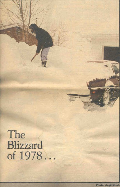
So here is what the National Weather Service is saying:


Winter Storm Watch

URGENT - WINTER WEATHER MESSAGE
National Weather Service Indianapolis IN
302 PM EST Mon Jan 31 2022

INZ061>065-067>072-011100-
/O.EXA.KIND.WS.A.0001.220203T0000Z-220204T0600Z/
Greene-Monroe-Brown-Bartholomew-Decatur-Knox-Daviess-Martin-
Lawrence-Jackson-Jennings-
Including the cities of Linton, Bloomfield, Jasonville,
Worthington, Bloomington, Nashville, Columbus, Greensburg,
Vincennes, Washington, Loogootee, Shoals, Bedford, Mitchell,
Seymour, and North Vernon
302 PM EST Mon Jan 31 2022

...WINTER STORM WATCH IN EFFECT FROM WEDNESDAY EVENING THROUGH
LATE THURSDAY NIGHT...

* WHAT...Heavy mixed precipitation possible. Total sleet and snow
  accumulations up to 3 inches and ice accumulations of one tenth
  to one quarter of an inch possible.

* WHERE...Portions of central, south central, southeast and
  southwest Indiana.

* WHEN...From Wednesday evening through late Thursday night.

* IMPACTS...Power outages and tree damage are likely due to the
  ice. Travel could be nearly impossible. The hazardous
  conditions could impact the morning or evening commute.

* ADDITIONAL DETAILS...There remains some uncertainty on the path
  of the storm which could impact precipitation types and amounts.

PRECAUTIONARY/PREPAREDNESS ACTIONS...

Monitor the latest forecasts for updates on this situation.
Area Forecast Discussion
National Weather Service Indianapolis IN
252 PM EST Mon Jan 31 2022

.Short Term...(This evening through Tuesday night)
Issued at 252 PM EST Mon Jan 31 2022

Quiet weather will continue tonight into early Tuesday, ahead of an
approaching cold front that will begin wave one of a substantial mid
week winter storm.

Broad southerly flow aloft and at the surface will produce a
substantial warmup ahead of the front into Tuesday with 50 degree
readings likely to make inroads well into central Indiana tomorrow
afternoon. Precipitation onset could be as early as Tuesday
afternoon in our northwest but will likely hold off until later in
the day as it will take some time for the atmosphere to fully
saturate. Will ramp pops up steadily late Tuesday afternoon to
categorical in the northwest by evening, then everywhere by late
Tuesday night.

The vast majority of Tuesday evening and night`s precipitation will
fall as rain, before the cold front makes enough progress into the
area to allow for a rapid transition to snow in the far northwest by
daybreak Wednesday. This transition zone will continue to make slow
but steady progress southeast beyond the short term period and into
the long term.

&&

.Long Term...(Wednesday through Monday)
Issued at 252 PM EST Mon Jan 31 2022

Key Points:

-- Still significant uncertainty on placement and amounts of ice,
and southern extend of more significant snowfall.

-- Significant snow amounts with potential tree limb and roof
impacts across the northern portion of the area.

-- Greater concerns for freezing rain and icing further south.

-- A swath of significant sleet accumulation possible.

-- Significant impacts to travel and some power grid impacts
possible.

-- Event-total liquid 2-3 inches raises concern for river flooding.

Meteorological Analysis and Uncertainties:

There are some synoptic-scale shifts that are contributing to
uncertainty, but the general pattern of waves of anafrontal
precipitation has been consistent in deterministic and ensemble NWP.
Specific details of where the baroclinic zone/front is, thermal
profile, and inherent microphyics considerations for precipitation
type are all not entirely clear at the moment. Of course, these have
significant implications for precipitation type, and timing
transitions within the context of QPF can make accumulation amounts
of freezing rain, sleet, and snow very difficult. We expect to gain
more clarity and overall forecast confidence in the next 24-36
hours.

We are concerned about the consistent QPF signal amidst supportive
thermal profiles for snow across our northern counties for
significant impacts. One limiting factor appears to be microphysics
related, and tied to the character of the thermal profile perhaps
supporting relatively low (near or just below climo) snow-liquid
ratio. It`s a broad warm nose with a deep isothermal layer just on
the cold side of 0C even for northern portions of the area, and some
riming may occur. This is the primary reason for questioning the
more extreme amounts of explicit 10:1 and Kuchera. Nevertheless,
snow impacts to travel and also including weight on roofs and trees
need to be considered within this heavy snow swath.

Since flow from the initial wave veers/weakens and mean flow
parallels the front, thus resulting in more anafrontal precipitation
with time, areas further south closer to the I-70 corridor may
experience a slower precipitation type transition. Initial shallow
cold surge will change rain to freezing rain, but for much of the
area the frontal slope should intrude far enough that the cold air
becomes deep enough for refreezing and sleet. A significant amount
of sleet may accumulate somewhere across the area depending on
timing of waves of ascent/precip and character of the warm nose. A
more amplified frontal wave and stronger flow atop the frontal slope
would support this. Sleet would be most likely south of the axis of
heavy snow and north of where the frontal slope is sufficiently
shallow for freezing rain.

There are growing concerns for freezing rain impacts, particularly
further south where shallow cold air mass seems likely to reach.
Even across the northern portion of the area a transient period of
freezing rain may be enough for a glaze of ice. We adjusted the
forecast for earlier arrival of cold and the entire area should be
sub-freezing by around sunrise Friday. Once we have higher
confidence on precipitation amounts within the time frame the
thermal profile is supportive of icing, and better assess accretion
potential using FRAM concept we will be more specific about amounts.
For now there is enough of a signal to include the southernmost
portion of the area in the Winter Storm Watch.

Storm total liquid equivalent precipitation of 2-3 inches raises
concern for river flooding late in the week and this weekend.

Forecast confidence decreases considerably once this system departs.
Some medium range deterministic guidance and ensemble members bring
a short wave trough into the area with enough moisture/ascent for
light precipitation this weekend. This seems low probability at this
time.


30 inches of snow for northern Indiana next week?

No! But it sure would be the talk of the nation if it did happen and it would far surpass the 24 inches of snow on the east coast this week.


#BOTS BLOOMINGTON!

 It's finally snowing! Enjoy it while it lasts. This might be it. You never know with the weather in Indiana.

Take a walk on the wild side...

Because that's what the weather is doing! 4 degrees tonight, 50 degrees a week from today, 60 degrees next Thursday and 5 degrees next Sunday. Yeah! 


From the National Weather Service:

.Short Term...(Today through Wednesday)
Issued at 238 AM EST Tue Jan 25 2022

...DANGEROUS WIND CHILLS TONIGHT AND EARLY TOMORROW...

Today and Tonight.

There have been a few flurries across central Indiana during the
overnight hours, but as clouds continue to scatter through daybreak,
expect that these should quickly come to an end. In the aftermath of
the cold front, strong CAA both at the surface and aloft will help
to bring the coldest air of the season so far to much of central
Indiana. Daytime highs today across Minnesota and southern Wisconsin
will be well below zero with surface winds advecting that air into
the area through the overnight hours. Across central Indiana, highs
will vary significantly from the north to the south with lows near
20 in the south while only 10 in the north.

That colder air from the northwest will continue to push into
central Indiana during the overnight hours and combined with mostly
clear skies will allow for temperatures to drop to near 0 for much
of the area with sub-zero temperatures across the northern counties.
Temperatures aloft will run even colder, so with no near surface
inversion, winds should remain gusty through the night into the
early daytime hours tomorrow which will allow for wind chills to
drop to near -20 across north central Indiana with increasing values
further south where the temperatures will remain higher. With all
this in mind, have elected to go with a Wind Chill Advisory across
those northern counties.

Wednesday.

Cool conditions then continue into Wednesday with a slow temperature
recovery with the continued CAA counteracting the diurnal radiational
warming.  Do think that temps should rise to the 15-20 degree mark
for most due to a gradual wind shift during the daytime hours to be
more southerly by mid afternoon.  Wind speeds will be relatively
minimal with a developing surface high across the area, but with the
loss of the CAA, radiational warming should win out for the day.

&&

.Long Term...(Wednesday night through Monday)
Issued at 238 AM EST Tue Jan 25 2022

A highly amplified pattern aloft will persist into the weekend...
anchored by a ridge over the eastern Pacific Ocean and West Coast
and a broad trough over much of the country east of the Rockies.
This will maintain a cold and largely dry pattern for the rest of
the week into the weekend with Arctic air across the region.

The only threat for any precipitation in the extended comes Thursday
and Thursday night as a weakening wave aloft tracks into the
Tennessee Valley and interacts with a cold front dropping out of the
upper Midwest. While the system will be lacking moisture
initially...the interaction of the features will generate lift with
the potential for areas of light snow to develop and impact the area
Thursday afternoon and night. At this point...light accumulations
under an inch would be possible in spots. Once the front passes...a
renewed surge of very cold air will advect into the region with the
combination of cold advection and lingering stratus in the cyclonic
flow behind the boundary potentially supporting a period for
flurries to linger into Friday before high pressure takes over.

Another strong area of high pressure will expand into the Ohio
Valley and Great Lakes for the weekend with cold and dry conditions.
Highs Friday and Saturday will only make it into the 20s with teens
for overnight lows. Upper level flow will recover by late weekend
into early next week in response to a portion of the western ridge
kicking east into the central Plains. Highs will respond in
kind...warming back into the 40s over much of the forecast area by
next Tuesday.


A BOTS! dream, if only.

Todays is the 44th anniversary of the Great Blizzard of '78. Sure would be nice wouldn't it? And can you guess which one of these cities is Bloomington Indiana?


Snow patrol update


Winter's last stand!

From today January 20th until February 6th we have two weeks and three days left to see a nice storm. After February 6th it turns warm again. That's not to say that we won't see anymore snow, it just means that the chance of seeing a big snow drops after that time frame. (*) (See disclaimer at the bottom of the page)


(*) We get snow in March and we got a decent snow last April. Remember that one?

Snow to our south again.

Later this evening and tonight it will snow in Kentucky while Indiana remains cloudy. Today is the last day in the mid 40's so enjoy it if you can. Starting tomorrow we will enter a much colder pattern that will last until about February 6 and then it will be warmer than average after that. So here we are; perhaps the last two weeks of winter. For #BOTS fans, it has to happen in the next two weeks.

Here is a very long discussion from the National Weather Service Office out of Indianapolis:

Area Forecast Discussion

National Weather Service Indianapolis IN

1233 PM EST Wed Jan 19 2022


...Updated Aviation Discussion...


.Forecast Update...

Issued at 1000 AM EST Wed Jan 19 2022


900 AM observations across central Indiana indicated a cold front

crossing the southeastern third of the state, with temperatures in

the subsequent frontal zone ranging from the mid-40s along the East

Fork of the White River to near 32F in far northwestern corners of

the CWA. Dry conditions were continuing under at least BKN post-

frontal mid/high cloud that was continuing to advance into and over

the region from the west.


A broad arctic air mass will build into the region today.  Winds

will continue to veer to northwesterly this morning before

increasing this afternoon with gusts as high as 15-20 knots for most

locations.  The 32F isotherm will slowly cross the northwestern

portions of the region through this afternoon, before quickly

advancing southeast of the I-70 corridor late today.  Plummeting

readings will already be in the mid 20s across northwestern zones by

early this evening. Latest guidance is continuing to indicate

chances of light rain to snow for far southern counties this

afternoon, although confidence is low in any accumulations exceeding

a thin coating by late day.  Any lake-effect snow flurries that may

reach our north-central/northeastern zones would not start until at

least late this evening.


&&


.Short Term...(Today through Thursday)

Issued at 255 AM EST Wed Jan 19 2022


Highlights...


*Falling temperatures throughout today from NW to SE. Overnight lows

in the teens with wind chill values near 0.


*Scattered showers transitioning into snow in far southern central

Indiana. Confidence in snow amounts is low, but only minor

accumulations expected at this time.


Today and Tonight..


Currently, temperatures are still unseasonably high across central

Indiana as SW flow continues to advect warm air over the region.

With some mid to upper level moisture increasing, cloud development

will become likely overnight with broken to scattered upper level

clouds by the morning.


To the north a deepening surface low will move off to the east,

opening a elongated channel of NW flow to approach central Indiana.

This will drop throughout the day as a cold front passes through

from NW to SE. With the front displaced from the surface low, the

temperature gradient will not be quite as steep as a typical

wintertime cold front, but gradual temperature decreases within

moderate CAA will occur this afternoon following frontal passage.

Also of note is the significantly drier air within the cold air

mass. This will create a steep moisture gradient across central

Indiana with dew points ranging 15+ degrees by Wednesday evening.


A second disturbance will approach from the SW throughout tomorrow,

increasing chances for precipitation over far southern central

Indiana the afternoon through tonight. As the low deepens, a

strengthening southerly LLJ will push higher low level moisture into

the Ohio Valley. This will eventually saturated the PBL, leading to

scattered showers. The strengthening southerly flow will work against

the advancing frontal boundary, keeping the mid to low level drier

air from reaching portions of southern Indiana. The opposed systems

will also develop a strong deformation zone, of which will be the

primary threat for increased QPF.


Although moisture will stay elevated north of the secondary low,

cold air will still move over south central Indiana, aided by

diurnal cooling. This should drop temperatures below freezing

leading to chances of snow. Snowfall will be likely within the

deformation bands this evening and overnight, but where these bands

are positioned is still in question. To add to the uncertainty is an

enhanced 850-700 moisture boundary, that will create steep QPF

gradients over southern Indiana. Current expectations are for

minimal accumulations over south central Indiana, but this could

change is the deformation bands develop further north. Observational

analysis will be paramount in future updates today.


Eventually, the secondary low will move off to the east, with dry

air encompassing central Indiana. Residual mid-level clouds could

inhibit some diurnal cooling in southern and southeastern central

Indiana, but a majority of central Indiana should see significant

temperature drops overnight with lows in the teens. This in

combination with sustained winds around 10-15mph will lead to wind

chill values near or below freezing. Elevated low level moisture

down stream of Lake Michigan should lead to some cloud development

over NE central Indiana overnight. This should lead to some

scattered flurries as the saturated layer interacts with

the cold air mass.


Tomorrow...


Much quieter weather will be in store for tomorrow as surface

pressure increases beneath the CAA. Skies should be mostly clear,

although some lake effect clouds will still be ongoing in northern

portions of the region.  A stay flurry is will still be possible

within this cloud cover. Temperatures will remain bellow normal with

highs in the mid 20s.


&&


.Long Term...(Thursday night through Tuesday)

Issued at 255 AM EST Wed Jan 19 2022


The long term will see several waves move through the area within

fast northwest flow aloft. That said, deep moisture will be lacking,

so confidence in anything more than low coverage light snow showers

or flurries at any one time is lacking. Confidence is much higher in

below normal temperatures each day.


Thursday Night through Friday Night.


A strong expansive high pressure ridge will extend from the southern

Plains to the Great Lakes late this week into the early weekend.

Meanwhile, a broad upper trough embedded within the northwest

flow aloft will move across on Friday followed by a quick moving

ridge Friday night. With only modest boundary layer flow off Lake

Michigan becoming northeasterly overnight Thursday night, do not

expect any lake effect snow showers to make it in our northwestern

counties. Meanwhile, aside for some thin low level moisture per

model soundings and rh time sections, the atmosphere will be way too

dry on Friday for any precip associated with the elongated upper

trough. Finally, even a more dry column combined with the

quick moving ridge will keep it dry Friday night as well.


Very cold boundary layer with 850 millibar temperatures to 16

degrees below zero Celsius, weakening winds and clearing skies

should allow overnight temperatures to bottom out in the teens

Thursday night and Friday night. Meanwhile, light winds will keep

wind chills from falling below zero. Afternoon highs will struggle

to reach the middle and upper 20s on Friday. Normal high

temperatures this time of year are in the 30s and normal lows

around 20 degrees.


Saturday through Tuesday.


Saturday should only see a very slight warmup as the broad surface

ridge well move over the southern states and block return flow from

the Gulf. This will also serve to keep the mid and low levels bone

dry ahead of another upper trough in the northwest flow aloft and

approach of a cold front from the northwest. Thus, will stick with

a dry and slightly warmer forecast for Saturday.


The aforementioned cold front will move through Saturday night and

another upper wave will follow Sunday. This should reinforce the

cold weather with only an increase in high clouds.


Will keep the remainder of the long term dry with less confidence of

timing on any waves in the northwest flow aloft and no tell tale

signs of a moisture influx.


Snow hole Indiana weather jokes!

As we all know by now, the major snowstorm is going around the state of Indiana. Here are some of the best jokes so far about "The Snow Hole" in Indiana.


Sorry #BOTS fans.

The latest data shows all storm going around the state of Indiana. Yes, literally. There's even a chance for some snow in Mexico!


The NWS Louisville Office

Posted this on Twitter a few moments ago. I've been warning about the arctic outbreak for a while. This is just more evidence.


Extreme cold keeps showing up for the last week of January.

Red is warm air and blue is cold air.


The trouble with snowcasting!

Here's a perfect example how the weather computer models disagree. The first image on the left has heavy snow. The one in the middle has no snow at all and the one on the right has a little bit of snow. Which one will be right? #BOTS!


The Indiana snow hole

Here it is:


Twitter is abuzz about snow in Indiana this weekend but once again, the GFS says nope. Look at how the storm goes around Indiana.


Here is the what the National Weather Service is saying:

.Long Term...(Wednesday night through Monday)
Issued at 256 AM EST Tue Jan 11 2022

Dry and quiet weather will continue into the the start of the short
term period. Central Indiana looks to sit under pretty persistent
upper NW flow, with a couple of transient shortwaves that may lead
to multiple chances for precipitation. The best chance for precip
comes late Friday into Saturday as models are showing a wave
separating off from the main flow pattern and becoming a small cut
off low. As we are still several days out, there is some variability
on the strength, timing, and track of this low, but there is
agreement at least in the low/ trough swinging across the SE states
this weekend. Some deterministic models are showing multiple inches
of snow with this wave while others show maybe half an inch, so
confidence is still low at this time and it`s too early to try to
nail down any specifics. The thermal profiles do at least support
snow, but much will depend on how far south the low ends up
tracking. If it ends up trending further south, central Indiana may
even end up being missed again for a decent snow event.

Additional chances for precip come with other short waves aloft, one
Thursday morning and another towards the end of the long term
period. Did up the PoPs for Thursday as models have been ramping up
the probability for some precip to fall over the NW. Kept with
guidance on dry weather for the end of the period given the lack of
confidence this far out, but will continue to monitor and add PoPs
in future runs if need be.

Temperatures will generally be near to slightly below normal through
the period, with the coldest days occurring this weekend in the wake
of the stronger low pressure system.


Book recommendations!

The low temperature will be 6 degrees tonight and the high temperature will be 21 degrees tomorrow. If I had the opportunity, I would stay in by the fireplace, sip on some hot green tea and read a good book. Has anyone ever recommend reading a book about the weather? Probably not but here a few to check out.

(Above is Indiana non-fiction)


(Above is Indiana Fiction)


Cold and boring!

The GFS computer model puts out forecasts up to 16 days ahead. The current run has no snow and plenty of chances for rain.


The last week of January is still showing signs of extreme cold.

The CFS model has been hinting at this since December 22 (see my previous posts) and is remaining consistent. 


We have a better chance at rain than snow this week.

I know that seems hard to believe but it's true. Here's the short version: There's a 20% chance of snow on Thursday and a 90% chance of rain Saturday night. That's all the excitement for this week. Here's the long version:

Short Term...(Today through Thursday)
Issued at 259 AM EST Wed Jan 5 2022

Quick Summary:

--Windy conditions will continue into the afternoon with gusts to
around 45 mph.

--Below zero wind chills Wednesday night.

--We`re confident in less snow Thursday and have trended
probabilities and amounts downward.

Meteorological Analysis:

The first shortwave trough and attendant surface low is moving across
the Great Lakes now, with a trailing cold front approaching our
area. Strong cold advection will start in central Indiana around
sunrise and continue through the day. Peak surface pressure
gradient driving the stronger winds will occur through at least
early afternoon, with a more substantial drop-off in wind speeds by
around sunrise as gradient continues to relax and modest mixing
subsides. We will extend the Wind Advisory through the afternoon,
although some sites may fall below traditional criteria before the
ending time. Also, we will see stronger gusts south of the
Advisory that may fall just short of criteria but mixing/momentum
transfer supports gusty winds there.

We trended temperatures toward raw guidance to eliminate any
influence of bias correction from calibrated/blended guidance.
Upstream trajectories are over snowpack so this will be a drastic
change. These much colder temperatures paired with residual
westerly surface winds yield wind chill values below zero
generally north of I-70 and in the single digits to the south
tonight.

We have trended precip/snowfall probabilities and amounts downward
based on trends in the guidance. We felt comfortable with this given
the fairly tight clustering of ensemble guidance from both ECMWF/EPS
and GEFS. Although some very low amounts remain on the northern
periphery, conceptually the cutoff of measurable precipitation in
these scenarios is often much sharper than what a blended/ensemble
approach with influence from a few outliers will show. So this
boosted our confidence to remove precipitation from
I-70/Indianapolis altogether. At this point, a slight northward
shift could involve our southernmost counties, including
Brownstown, Seymour, and North Vernon with meaningful snow
amounts, but the greatest snow impacts are expected further south
in Kentucky.

A little deeper explanation--since we are seeing better agreement
among ensemble and deterministic guidance it`s easier to look at
deterministic model details to better understand the physical
processes at play. Strong PV forcing in deterministic guidance is
focused across southern Indiana into Kentucky, and this is where
thermal tightening/frontogenesis and deeper saturation and omega
within the dendritic growth zone resides. This region will see a
better chance of saturating dry low levels from recent cP
intrusion as well.

&&

.Long Term...(Thursday night through Tuesday)
Issued at 259 AM EST Wed Jan 5 2022

Thursday Night Through Friday Night.

Dry weather is expected for Thursday night as the shortwave that is
expected to bring snow to southern Indiana on Thursday continues to
move further to the east.  In its wake, temperatures will plummet as
strong CAA aloft and at the surface bring the coolest air of the
season thus far with lows in the single digits across central
Indiana. This combined with the northwesterly winds of 10-15 mph
will create periods where wind chills drop below zero and perhaps as
low as -10 at times.

The cold temperatures will continue through the day with highs in
the upper teens to near 20 with wind chills maxing out in the single
digits. This northwesterly CAA will brief with southerly flow
returning late Friday into Friday night.

Saturday through Tuesday.

The pattern is then expected to shift going into Saturday as the
southerly flow strengthens and a LLJ moves over the area. By late in
the overnight hours, precipitation chances return as a broad upper
level trough pushes through southern Canada with a surface front
extending southwards towards Texas.  Ahead of the front, southerly
Gulf air will push into central Indiana with PWAT values of around
an inch Saturday night.

While surface temperatures may lag ahead of the precipitation, model
soundings show plenty of warm air aloft which will keep rain the
predominant precipitation type through the first part of the event.
Towards the back end, CAA will quickly move into the area both at
the surface and aloft which may allow for a brief transition to snow
as the rain exits the area.  Will continue to monitor this in the
upcoming days as the p-type will be heavily dependent on the timing
of the frontal passage and the strength of the WAA ahead of the
front.

Going into early next week, northwesterly flow aloft and near the
surface will keep temperatures near to slightly below normal with
generally dry weather as the atmosphere remains dry through the
column.

#BOTS update.

There is talk of snow on Thursday but the GFS doesn't see it. It sees a warm up and rain.