March 1st marks the start of meteorological spring.

Having said that, it's time to retire the #BOTS hashtag. I know there will be some instances of snow in March but we got our big one and spring-like temperatures are on the horizon. Here's the latest from the National Weather Service:

.LONG TERM /Monday through Thursday/...
Issued at 309 AM EST Fri Feb 26 2021

The first week of March will most likely exhibit generally tame
conditions. There is at least moderate confidence that the polar
jet will lift north of the region, closer to southern Canada. A
couple cut-off circulations caught in the remaining southern
stream will present slight chance to chances of light
precipitation while passing to the south of central Indiana.
Confidence on the details of these rather small features is low to
moderate...with any light rain to most likely cross Indiana in
the Tuesday and Thursday time frames...with the threat of some wet
snowflakes mixing in during chillier morning hours, especially
across northern counties. Although certainly little or no impact
is expected at this time.

Otherwise the period should begin seasonably chilly but very
pleasant under clear skies Monday-Monday night as seasonably
strong high pressure advances into the Mid-West. Gradients are
progged to slacken through the rest of the period as the jet
retreats north and the broad, flat ridge builds over much of the
US. Winds should be constrained to light breezes most of the time,
under consistently partly cloudy skies. Temperatures are expected
to gradually moderate through near normal to slightly above
normal levels during the period.

#BOTS!

Keep an eye on the weather. Do not travel Monday night. Don't do it. Whatever it is, it can wait. With winds gust at 30 MPH, that will be "near" blizzard-like conditions.

Be careful and stay safe.

See you on the flip side.

Surprise, surprise!

The weather computer models are shifting the storm to the east. It now looks like Ohio will get the heavy snow. I think Bloomington will see 4-5 inches.  

Oh well, #BOTS!


NWS Severe Weather Symposium has been posted.

It's a little early for this but here is the link to register for the class if you are interested.

https://drive.google.com/file/d/1q2w76cPIJrbwWoJCiQIrDHAQqRyMer3S/view


A Winter Storm Watch has been issued for our area and central Indiana.

 URGENT - WINTER WEATHER MESSAGE

National Weather Service Indianapolis IN
310 PM EST Fri Feb 12 2021

INZ036-037-039>049-051>057-060>065-067>072-130415-
/O.NEW.KIND.WS.A.0002.210215T0600Z-210216T1200Z/
Montgomery-Boone-Hamilton-Madison-Delaware-Randolph-Vermillion-
Parke-Putnam-Hendricks-Marion-Hancock-Henry-Vigo-Clay-Owen-Morgan-
Johnson-Shelby-Rush-Sullivan-Greene-Monroe-Brown-Bartholomew-
Decatur-Knox-Daviess-Martin-Lawrence-Jackson-Jennings-
Including the cities of Crawfordsville, Lebanon, Zionsville,
Fishers, Carmel, Noblesville, Anderson, Muncie, Winchester,
Clinton, Newport, Rockville, Greencastle, Plainfield, Brownsburg,
Danville, Indianapolis, Greenfield, Cumberland, New Castle,
Terre Haute, Brazil, Clay City, Spencer, Martinsville,
Mooresville, Greenwood, Franklin, Shelbyville, Rushville,
Sullivan, Linton, Bloomfield, Bloomington, Nashville, Columbus,
Greensburg, Vincennes, Washington, Loogootee, Shoals, Bedford,
Mitchell, Seymour, Brownstown, and North Vernon
310 PM EST Fri Feb 12 2021

...WINTER STORM WATCH IN EFFECT FROM LATE SUNDAY NIGHT THROUGH
TUESDAY MORNING...

* WHAT...Heavy snow possible. Total snow accumulations of 5 to 7
  inches possible.

* WHERE...Portions of central, east central, south central,
  southeast, southwest and west central Indiana.

* WHEN...From late Sunday night through Tuesday morning.

* IMPACTS...Travel could be very difficult. The hazardous
  conditions could impact the morning or evening commute.

* ADDITIONAL DETAILS...Uncertainty on the specific track of this
  storm system remains high. A change in the path of the storm
  could have large impacts on snowfall amounts. It is important to
  stay weather aware this weekend for the latest updates to the
  forecast.

PRECAUTIONARY/PREPAREDNESS ACTIONS...

Monitor the latest forecasts for updates on this situation.

All eyes turn to next week but looker beware.

I know it's hard to resist but this is the time to stay away from social media because someone is going to be really disappointed. I've seen everything from one extreme to the other and all the stuff in the middle when it comes to posts about the storm for next week. Here are two examples:

This guy posted a map showing 10+ inches in Monroe County:


This guy posted a map showing that we get 0, as in nothing because the cold arctic air will force the storm to our east:


The best thing to do is to trust the professionals at the National Weather Service.

You can download the NWS mobile app by following these instructions.


The latest details from the National Weather Service office in Indy.

Area Forecast Discussion

National Weather Service Indianapolis IN

952 AM EST Wed Feb 10 2021


.UPDATE...


The Near Term section has been updated below.


.SYNOPSIS...

Issued at 408 AM EST Wed Feb 10 2021


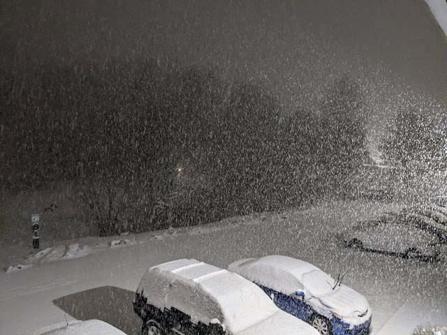
Today will bring chance for snow across the area with total

accumulations of 1 to 2 inches possible in northern central

Indiana and up to an inch in the south. More chances for snow are

possible this weekend and again early to mid next week. Below

normal temperatures will continue throughout the forecast period

with the start of next week set to be some of the coldest days.


&&


.NEAR TERM /Today/...

Issued at 952 AM EST Wed Feb 10 2021


Going forecast is in fine shape and required only minor adjustment -

regional radar mosaic shows plenty of light returns across the area

but little reaching the ground just yet as dry low level air causes

some evaporation/sublimation of precipitation. Should see returns

expand in coverage and intensity as the day wears on per high res

model solutions, and this is in line with the going forecast.

Previous discussion follows.


Issued at 408 AM EST Wed Feb 10 2021


Radar and surface observations show that scattered light

precipitation is starting to move into southern Indiana as of the

early morning hours. This precip will expand northward through the

morning.


An upper jet over the Ohio Valley will interact with a baroclinic

zone and subtle isentropic lift in the mid to low levels that is

bringing in the precipitation today. Warm moist air from the south

will overrun cold northerly air at the surface. For most of central

Indiana, temperature profiles will remain entirely below freezing

but in the south freezing rain may mix in at times where the warm

nose aloft has a better chance of getting above freezing. The more

significant impacts with this system are slated to stay further

south, for our neighbors in Kentucky. While our souther tier of

counties could see some ice mix in, we are not expecting much in the

way of ice accumulations. Will continue to monitor conditions

through the day, keeping an eye on how far north above freezing

temperatures reach. If they do push further north than currently

forecasted, icing impacts could creep into our forecast area.


Later in the day, a deformation band is expected for form north of I-

70. This band will create an area of enhanced lift and higher QPF

and snowfall totals, of 1 to 2 inches, for the northern half of the

forecast area.


At the surface, temperatures today will range from the low 20s in

the north to the upper 20s in the south.


&&


.SHORT TERM /Tonight through Thursday Night/...

Issued at 408 AM EST Wed Feb 10 2021


The system impacting the region today will start to slowly push

out of the area tonight into Thursday. Light snow will continue to

be possible into Thursday but with minimal moisture, additional

snow accumulation is not really expected beyond tonight. Models

show that the band of moisture will stay to the south in Kentucky

and Tennessee during the short term period as the surface boundary

becomes more stationary across the SE states.


Any lingering precipitation should completely move out by tomorrow

night as the boundary pushes further SE and surface high pressure to

the NW stretches into the area and dries up the atmospheric column.


Below normal temperatures will continue through the period with

highs in the 20s and lows in the teens.


&&


.LONG TERM /Friday through Tuesday/...

Issued at 240 AM EST Wed Feb 10 2021


The main storyline for the extended remains focused on the continued

cold and active pattern for much of the eastern part of the

country...with another surge of bitterly cold air for the weekend

into early next week as a piece of the polar vortex swings across

the Great Lakes along with the potential for additional wintry

mischief into early next week.


A continued blocky and amplified flow pattern aloft will keep the

region stuck in a pattern conducive for continued cold and multiple

opportunities for snow into early next week. The two lobes of the

polar vortex over central Canada late this week will eventually

coalesce then swing south and east across the Great Lakes and

northeast by early next week...carving out a deeper parent trough

across the eastern half of the country and essentially opening the

door for a renewed push of bitterly cold air to advect south

into the region for this weekend and early next week.


At the surface...the Ohio Valley will remain between a large area of

strong high pressure dropping down the east side of the Canadian

Rockies and a stagnant frontal boundary over the Southeast states

early in the period with the high becoming the primary feature

influencing our weather by late Saturday into early next week.

Extended model guidance continues to struggle with the level of

phasing between energy diving south with the PV lobe and just how

much it interacts with the leftover boundary extending from the Gulf

Coast to the Mid Atlantic region. At this point...think potential

certainly exists for some snow at times over the weekend but leaning

towards a less phased setup with lighter snows and accumulation.


A more interesting setup begins to take shape early next week as the

PV lobe kicks out to the northeast and focus turns towards an upper

wave amplifying over the Intermountain West this weekend. As this

feature traverses east into Monday and Tuesday...there does appear

to be a higher ceiling for energy phasing aloft between the polar and

subtropical jets and subsequently...a potential for a deeper surface

wave over the region. With the strong surface high still present

north of the Ohio Valley...there is a threat for a more substantial

winter storm to impact the area with snow and/or ice as plenty of

the remnant arctic airmass from the weekend remains. Another factor

that will likely influence how this plays out is the position of the

southeast ridge and whether it flexes enough to draw warmer air

aloft into the region above a shallow cold airmass. There are a lot

of moving parts here and we remain several days out...but the

potential for a higher impact winter storm does appear to be growing

for early next week.


Temperatures over the weekend will rival the cold blast from this

past weekend with highs bottoming out in the single digits and teens

on Sunday and subzero lows possible in some parts of the forecast

area both Saturday and Sunday nights. Some temperature recovery will

develop by early next week but the overall temperature trend will

remain well below normal for mid February.


#BOTS! Winter Weather Advisory

 #BOTS!


Winter Weather Advisory

URGENT - WINTER WEATHER MESSAGE
National Weather Service Indianapolis IN
211 PM EST Mon Feb 8 2021

INZ055>057-060>063-090315-
/O.EXB.KIND.WW.Y.0004.210208T2300Z-210209T1200Z/
Johnson-Shelby-Rush-Sullivan-Greene-Monroe-Brown-
Including the cities of Greenwood, Franklin, Shelbyville,
Rushville, Sullivan, Linton, Bloomfield, Bloomington,
and Nashville
211 PM EST Mon Feb 8 2021

...WINTER WEATHER ADVISORY IN EFFECT FROM 6 PM THIS EVENING TO
7 AM EST TUESDAY...

* WHAT...Snow expected. Total snow accumulations of 2 to 3 inches.
  Isolated locations could see accumulations greater than 3
  inches.

* WHERE...Portions of central, south central and southwest
  Indiana.

* WHEN...From 6 PM this evening to 7 AM EST Tuesday.

* IMPACTS...Plan on slippery road conditions. The hazardous
  conditions could impact the morning or evening commute.


PRECAUTIONARY/PREPAREDNESS ACTIONS...

Slow down and use caution while traveling.

The latest road conditions for Indiana can be obtained by
calling 1 800 2 6 1 7 6 2 3

Bloomington in the crosshairs!


Is that dynamic cooling I see right over Bloomington?


Dynamic Cooling: Occurs when strengthening storms produce strong upward motion and heavy precipitation that cools the atmosphere. The cooling happens because of two things. First, rising air cools as it becomes surrounded by a cooler environment and is further removed from the source of heat (sun-warmed surface objects). Second, heavy frozen precipitation falling into a warm layer will result in latent heat being transferred from the air to the melting hydrometeors so that a phase change (solid to liquid) can occur. The net loss of heat energy in the air will cause it to cool.

@12:15pm 2/4/2012 Sleet falling right now in Bloomington Indiana.

I headed out to see my favorite food truck on my lunch break and observed sleet.

Get ready for the polar vortex.


What a wild ride in the weather department.

You can't rely on anything more than 3 days out. A week to ten days ago all the data suggested that February was going to be warm and above average in temperatures. A week before that the data suggested that the polar vortex would arrive last week. Now it looks like the polar vortex is set to arrive next week but that could also change. Keep an eye on your weather apps but don't trust them past the third day. Here is the latest analysis from the National Weather Service office out of Indianapolis:


.SHORT TERM /Tonight through Wednesday Night/...

Issued at 224 AM EST Mon Feb 1 2021

Strong subsidence throughout the short term period will keep
conditions dry as a broad area of high pressure overtakes the
central U.S. The ridge axis is progged to be over the Plains by
tonight, shifting eastward throughout the short term period and
eventually reaching the Great Lakes Region on Wednesday night.

The strong northerly winds will persist into tonight with gusts
up to 25 mph, but the gradient will begin to relax a bit by
Tuesday. The northerly flow will help keep temperatures below
normal though for most of the period with lows dipping into the
teens and 20s tonight and Tuesday night, and daytime highs only
topping off in the upper 20s to mid 30s on Tuesday. However, as
the surface flow becomes southerly on Wednesday, a brief warming
trend will commence. Daytime highs on Wednesday will top off in
the low to upper 30s with slightly warmer temperatures in the low
to upper 20s on Wednesday night.

&&

.LONG TERM /Thursday through Monday/...

Issued at 258 AM EST Mon Feb 1 2021

The long term will focus on two features, helping produce
precipitation on Thursday and then sub-seasonal temperatures next
weekend.

A low pressure system will begin to develop in the lee of the
Rockies Wednesday, moving eastward along a neutrally oriented upper
level trough. Primary cyclogenesis will be within the left exit
region of a 400-300mb upper level jet. The lack of significant
advection and dynamic alignment should keep this system rather
mundane. However, an influx of moisture out ahead of the trough
will help invigorate precipitation development slightly, with
overall QPF totals expected between 0.25"-0.5" over central
Indiana. P-type should mostly be rain as central Indiana is
located within the warm sector, although some mixed precipitation
during onset is possible.

Further into the period a majority of ensemble members are in decent
agreement, especially for 150+ hours out, indicating strongly below
seasonal temperatures next weekend. A positively tilted mid to upper
level trough will reinforce the the southward progression of an
arctic airmass into the eastern half of the CONUS. This is
supported by a strongly negative AO depicting weak inertial
stability of the polar jet. Given this combination of factors,
confidence in a cold snap during days 6 through 7 is trending
upwards. Current ensemble means are showing 1000-500mb thickness
values below 4900 indicative of an extremely cold air mass.
Although, exact temperature values are hard to predict and will
vary as models ingest observations in the coming days. Overnight
lows on Saturday night are expected to be in the single digits,
but below zero values are not out of the realm of possibilities.