https://earth.atmo.ai/precipitation@35.69614,-95.22827,2.89,0,0,1711756800,9.00
Eclipse weather for April 8th?
Since Monday, the GFS have been consistently forecasting rain on every run. And the new Artificial Intelligence forecast agrees with it.


@2:00pm there are reports of a tornado in Madison Indiana
The radar signal is definitely there!
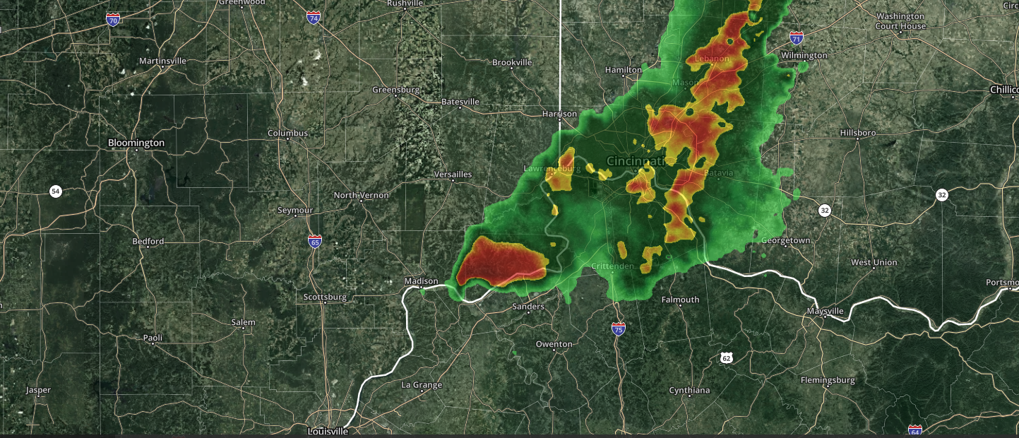

Tornado Warning
Severe Weather Statement
National Weather Service Wilmington OH
220 PM EDT Thu Mar 14 2024

INC155-KYC041-141830-
/O.CON.KILN.TO.W.0007.000000T0000Z-240314T1830Z/
Switzerland IN-Carroll KY-
220 PM EDT Thu Mar 14 2024

...A TORNADO WARNING REMAINS IN EFFECT UNTIL 230 PM EDT FOR
SOUTHWESTERN SWITZERLAND AND CARROLL COUNTIES...

At 220 PM EDT, a radar confirmed tornado was located near
Carrollton, moving east at 45 mph.

HAZARD...Damaging tornado and golf ball size hail.

SOURCE...Radar confirmed tornado. Radar shows tornado debris in the
         air.

IMPACT...Flying debris will be dangerous to those caught without
         shelter. Mobile homes will be damaged or destroyed. Damage
         to roofs, windows, and vehicles will occur.  Tree damage is
         likely.

Locations impacted include...
Carrollton, Vevay, Ghent, Sanders, Worthville, Prestonville,
Braytown, Interstate 71 at Mile Marker 52, Interstate 71 at State
Route 227, Langstaff, English, Eagle Station, Easterday, General
Butler State Park, and Carson.

This includes I-71 in Kentucky between mile markers 43 and 53.

PRECAUTIONARY/PREPAREDNESS ACTIONS...

To repeat, a tornado is on the ground. TAKE COVER NOW! Move to a
basement or an interior room on the lowest floor of a sturdy
building. Avoid windows. If you are outdoors, in a mobile home, or in
a vehicle, move to the closest substantial shelter and protect
yourself from flying debris.

To report severe weather, go to our website at weather.gov/iln and
submit your report via social media, when you can do so safely.

&&

LAT...LON 3879 8520 3877 8501 3876 8502 3865 8494
      3865 8497 3863 8499 3863 8501 3861 8503
      3861 8506 3864 8520
TIME...MOT...LOC 1820Z 283DEG 38KT 3870 8517

TORNADO...OBSERVED
MAX HAIL SIZE...1.75 IN

$$

Hatzos
Severe Weather Statement
National Weather Service Louisville KY
221 PM EDT Thu Mar 14 2024
INC077-141831-
/O.EXP.KLMK.TO.W.0003.000000T0000Z-240314T1830Z/
Jefferson IN-
221 PM EDT Thu Mar 14 2024
...THE TORNADO WARNING FOR SOUTHEASTERN JEFFERSON COUNTY WILL EXPIRE
AT 230 PM EDT...
The storm which prompted the warning has moved out of the area.
Therefore, the warning will be allowed to expire.
To report severe weather, contact your nearest law enforcement
agency. They will relay your report to the National Weather Service
Louisville.
LAT...LON 3869 8520 3870 8522 3873 8525 3875 8525
3875 8520
TIME...MOT...LOC 1821Z 267DEG 39KT 3871 8517
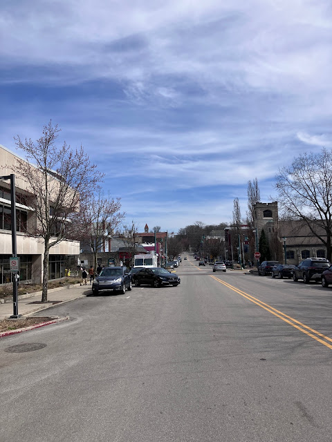
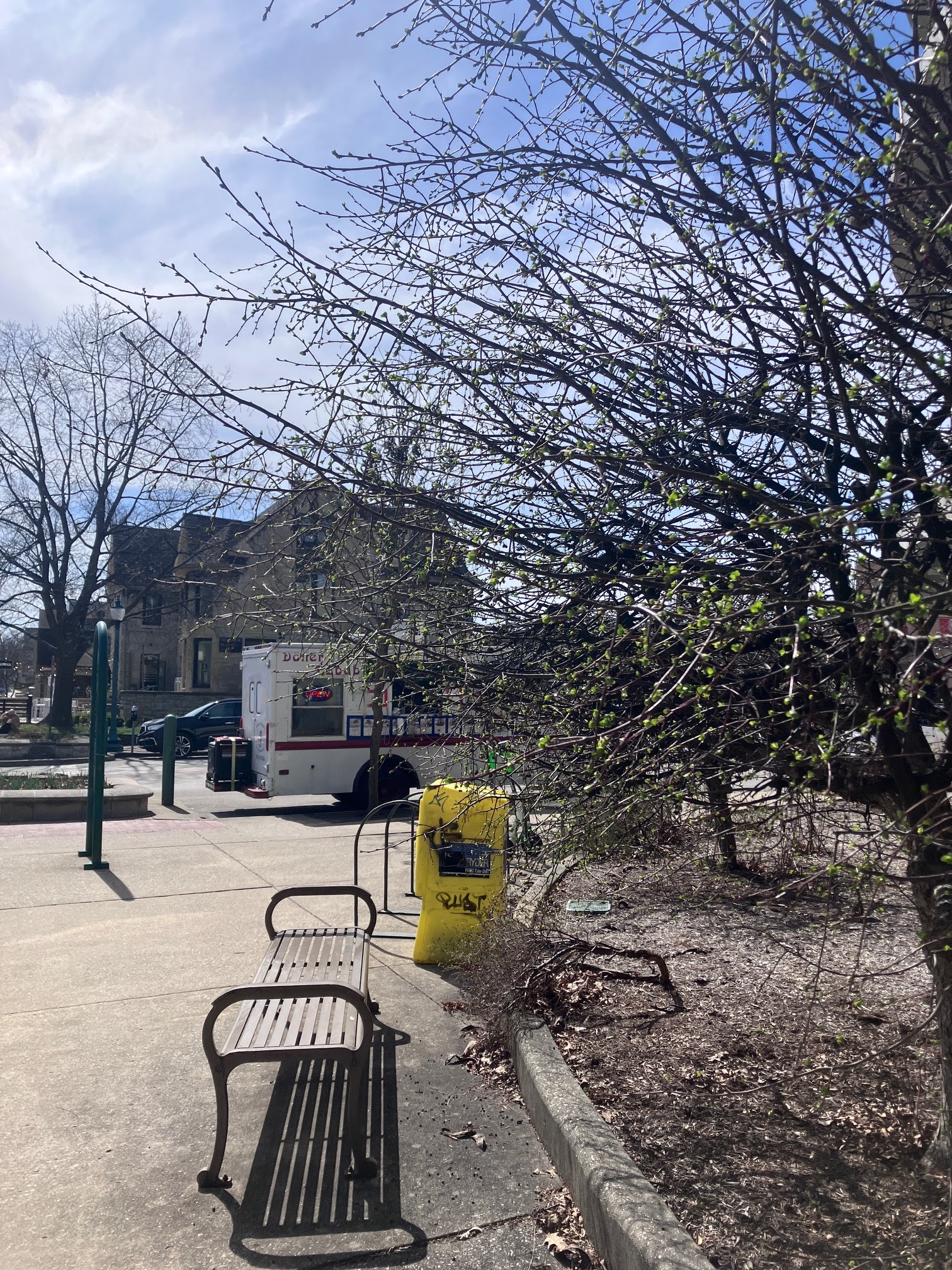
I bet you think winter is over don't you?
The flowers and trees are blooming in Bloomington. Is that why this place is called Bloomington? Oh well, enjoy the nice weather on Kirkwood this week. Changes are coming!


GFS Forecast for 3/18

GFS Forecast for 3/27

In the picture above, that snow showing up in Tennessee, Alabama and Georgia is possible but unlikely. I think it will end up being right over Indiana.
Here is what the National Weather Service is saying about long range forecast:
.LONG TERM (Wednesday through Monday)...
Issued at 254 AM EDT Tue Mar 12 2024

Wednesday into Thursday Night...

A weakening upper short wave will move into the area Wednesday. Deep
moisture will be lacking. Thus, any showers that survive into
central Indiana Wednesday morning should weaken or dissipate
completely. Will have some slight chance PoPs during the morning,
but will go dry in the afternoon with the lack of any forcing.

Wednesday night into Thursday morning, a warm front will move
northeast through the area. A low level jet will bring moisture and
forcing along with the warm front. Thus, will go with likely PoPs
over much of the area later Wednesday night and likely or higher
PoPs all areas Thursday morning.

Questions then arise for additional forcing Thursday afternoon
before a low pressure system brings widespread forcing Thursday
night. Some models indicate upper energy moving through Thursday
afternoon, sparking off some showers and storms. Others keep best
chances for rain near the warm front across northern Indiana. With
the uncertainty, will not deviate much from blended guidance`s low
likely PoPs north (closer to the warm front) and chance PoPs south.

Will go likely PoPs Thursday night as the low pressure system
interacts with plentiful moisture and a continued low level jet.

If the atmosphere can recover from Thursday morning`s rainfall,
instability and shear will be high enough for a conditional severe
thunderstorm threat later Thursday afternoon into Thursday night.
Uncertainty remains high though given impacts from morning rain as
well as potential interference from stronger convection to the south
and west of central Indiana.

Warm air will remain across central Indiana with highs in the 60s to
lower 70s and lows in the 50s.

Friday and Saturday...

A cold front will move through on Friday, but best moisture will be
east of the area. Will keep some lower PoPs around, mainly Friday
morning. Friday night and Saturday, the area will be in between
systems and dry.

Saturday night and beyond...

An upper trough will approach the area through Sunday and then move
in for Monday. Ahead of it, a cold front will move through on
Saturday night. Moisture will be mainly tied up to the south with a
southern system, Will go dry most areas through Sunday.

As cold air aloft moves in with the upper trough on Monday, a few
snow/rain showers will be possible.

Temperatures will fall to below normal on Monday, with highs only in
the lower to middle 40s. Monday night`s lows will be in the 20s.

Models are hinting at the cold temperatures may not last as long as
previously thought, with zonal flow potentially returning by Thursday
the 21st.
Happy first day of spring!
Meteorological Spring that is. Astronomical Spring starts on March 20, 2024. And yes, there is still a chance to get more snow this month.


Subscribe to:
Posts (Atom)