Next Wednesday's low temperature will be 35 degrees, not -20 degrees.

 Mistakes. They happen.


.SHORT TERM /Saturday through Sunday night/...
Issued at 358 AM EST Fri Jan 29 2021

A strong upper low pressure system will swing out of the plains
and northeastward toward Missouri and then Illinois on
Saturday/Saturday night. Initially this system moves quickly and
the trough is negatively tilted, but as it arrives in the mid
Mississippi valley it slows down, straightens up and flattens out,
and from there on its motion is very slow across the Ohio valley.
The surface low spends Saturday night to Sunday night tracking
from western Illinois across southern central Indiana to Ohio.

Strong isentropic lift will develop on Saturday afternoon ahead
of the low, and a low level jet will provide ample lift and
moisture transfer ahead of the low. Still some uncertainty
regarding how far north the warm air gets Saturday night on the
nose of the low level jet, and this will have a large impact on
which areas get rain or a rain snow mix versus snow. That said,
models have come into good agreement on the track of the low, if
not great agreement on the thermal profiles. Very strong lift will
be in place Saturday evening/Saturday night with the
aforementioned isentropic lift along with good q vector
divergence aloft. With the track of the 700 mb low right across
central parts of the area as well, looks like the band of heavy
snow could include northern/northeastern counties. With this in
mind and potential for 6 plus inches of snow over the
northern/northeastern counties, issued a Winter Storm Watch for
that area. Also of note, snow should be of the heavy and wet
variety, and there is some potential for 30 mph wind gusts to come
along with it. Central and southern parts of the area are more
likely to get into that warm nose and see enough warming that
changeover to a mix and then rain could be pretty quick Saturday
night, and thus left the rest of the area out of the watch.

Sunday during the day, the surface low tracks slowly enough that
warming will be in place for most of the day and expect
precipitation to be mainly rain, with the possible exception of
the northernmost counties. By late Sunday afternoon, though, the
low should be over Indiana or moving just east, allowing some of
that cold air to move back in behind it. This should bring a
change back over to snow. Since the system is moving so slowly,
there is still plenty of forcing from the upper system over us.
Thus keep chances for snow going through Sunday night, with
wraparound potential lasting into Monday morning. While there is
some chance for accumulating snow to ramp back up a little Sunday
evening, the event will likely be diminishing at that point as
forcing weakens and moisture is cut off.

Could wind up seeing total precipitation amounts over an inch
across the area given the setup and moisture. With things being
relatively dry though and streams running well below normal,
should be able to handle this moisture without widespread flooding
issues.

&&

.LONG TERM /Monday through Thursday/...
Issued at 350 AM EST Fri Jan 29 2021

While the progressive mid-level pattern for the period will perhaps
exhibit more amplification than earlier this winter, when some of
the southern-stream systems` circulations wholly cut-off from the
northern jet...true arctic air will still be very much absent from
the northwest flow entering Indiana Monday morning.  Nevertheless,
following any last snow showers that should taper off during the day
Monday...the approaching surface high will bring near to slightly-
below normal temps to start the work week. Residual considerable
cloudiness will likely linger Monday from the departing winter
storm`s last lobe of troughiness. Upper level ridging will then
join the surface ridge`s building-in amid the mid-level`s greater
amplification...providing a decently pleasant-for-mid-winter
Tuesday-Wednesday, featuring lighter winds and partly to mostly
clear skies.

Moderation should follow around the Wednesday time frame courtesy
southeasterly flow as the surface high drifts to the east. Attention
will soon thereafter turn to the next mid-latitude storm that will
be coming out of the Rockies.  Some disagreement exists on how fast
this next system deepens at the surface, although there is at least
moderate confidence its central pressure drops significantly by late
Wednesday over the central High Plains, before tracking a good ways
to our region`s west on Thursday. Guidance is indicating this
system`s wave may actually tap into at least a piece of arctic
air by late week, although this detail will be hammered out in the
days to come. For central Indiana, progged to be on the system`s
generally warm side, southerly breezes should provide an ample
ribbon of Gulf moisture. The storm`s cold front will focus at
least chances of rain, or mix-to-rain Thursday.

Temperatures for the period through Wednesday are expected to range
from morning lows in the ~20F realm, while afternoon highs slowly
moderate through the 30s for most locations. Wednesday night-
Thursday is expected to feature readings well above normal.

#BOTS FANS!

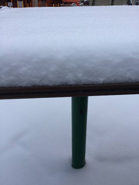
 It's wasn't even a big snow but it was fun to watch. I think we got about three inches. Enjoy!


I think winter is over for us.

We have one more shot at snow tomorrow night into Thursday morning. After that it warms up and next week is the very short month of February with only 28 days. 

Wednesday's high temperature will be 33 degrees with a 30% chance of snow. It will not be a great day to go golfing.

#BOTS

#BOTS Update: 1 Week left

If we don't get any snow by January 28th or by next Thursday then winter is about over. That doesn't mean it won't snow again because we can see snow here as late as April. What it means is that the cold air will start to retreat and our chances of seeing a big snow storm will go down.
#BOTS

The snow gods favor us today! #BOTS!

How lucky could we be? There will be a very thin stripe of snow coming tonight. It will cover about 13 counties in the southern part of the state and ours is one of them. #BOTS!


From the National Weather Service

Special Weather Statement

Special Weather Statement
National Weather Service Indianapolis IN
607 AM EST Fri Jan 15 2021

INZ021-028>031-035>049-051>057-060>065-067>072-152130-
Carroll-Warren-Tippecanoe-Clinton-Howard-Fountain-Montgomery-
Boone-Tipton-Hamilton-Madison-Delaware-Randolph-Vermillion-Parke-
Putnam-Hendricks-Marion-Hancock-Henry-Vigo-Clay-Owen-Morgan-
Johnson-Shelby-Rush-Sullivan-Greene-Monroe-Brown-Bartholomew-
Decatur-Knox-Daviess-Martin-Lawrence-Jackson-Jennings-
Including the cities of Delphi, Flora, Williamsport,
West Lebanon, Lafayette, West Lafayette, Frankfort, Kokomo,
Attica, Covington, Veedersburg, Crawfordsville, Lebanon,
Zionsville, Tipton, Fishers, Carmel, Noblesville, Anderson,
Muncie, Winchester, Clinton, Newport, Rockville, Greencastle,
Plainfield, Brownsburg, Danville, Indianapolis, Greenfield,
Cumberland, New Castle, Terre Haute, Brazil, Clay City, Spencer,
Martinsville, Mooresville, Greenwood, Franklin, Shelbyville,
Rushville, Sullivan, Linton, Bloomfield, Bloomington, Nashville,
Columbus, Greensburg, Vincennes, Washington, Loogootee, Shoals,
Bedford, Mitchell, Seymour, Brownstown, and North Vernon
607 AM EST Fri Jan 15 2021

...Briefly Intense Snow Showers or Squalls Likely Later Today and
Tonight...

Scattered snow showers are expected to develop during the course
of the day today, and from the midday hours into the evening
hours, some of these snow showers may become intense or squall
like in nature, with briefly intense snowfall rates, severely
reduced and rapidly varying visibilities, and slick spots
developing on roads and other surfaces due to minor snow
accumulations.

If traveling today and tonight, be alert for the potential for
these hazards, and if encountering them, drive carefully. Slow
down and increase distances between vehicles until conditions
improve markedly.

I think "Snow Squalls" are worse than blizzards.

Why? Because Blizzards come with warnings for a particular geographical area. Snow squalls are like severe storms and tornadoes in April. It's will be sunny one minute and then the clouds will  turn dark and then a storm is upon you. That's exactly what snow squalls are like. You never see them coming and once it happens, there's wind driven snow and blinding white-out condition for 15 minutes. After that, the sun is out and you think it's over except it's not. Blizzards allow you time to prepare. Snow squalls do not because they are random. Here is what the National Weather Service office from Indianapolis is saying:

.SHORT TERM /Friday and Friday Night/...
Issued at 314 PM EST Thu Jan 14 2021

Forecast challenges focus on a growing confidence in a potential
high impact convectively induced snow shower/squall setup for Friday
afternoon and evening as the upper low drifts across the region.

The upper low will track slowly east through the period from western
Illinois to eastern Indiana with a weakening surface reflection
following in tandem. The presence of both features will produce an
increase in forcing aloft over the region that is set to peak during
the afternoon and evening hours. The real story though is set to
unfold at the mesoscale level within the thermodynamic structure of
the low levels where parameters are set to align to provide
potentially the best convective setup for snow showers experienced
locally within the last 2 years or so. High confidence exists in
potential localized travel impacts throughout the afternoon and
evening hours Friday.

Scattered snow showers are possible through the morning and will
largely focus over northern counties. After 18Z though is when the
atmosphere will start to set up nicely for the convective threat as
the upper low moves into the area. Model soundings are extremely
impressive in the 18-00Z timeframe in support of heavier bursts and
snow rates within showers and developing squalls. Dry adiabatic flow
is set to peak at a level up to 700mb with weak instability present
through the boundary layer and steepening lapse rates that will peak
at 8C/km or greater below 800mb and potentially in the 9-9.5C/km
range in the lowest 2kft or so. Furthermore...the dry adiabatic
layer will coincide with the dendritic growth zone by mid to late
afternoon. This will result in an increasing coverage of snow
showers with locally brief heavy rates of snowfall that may approach
meeting snow squall criteria over a 3-5 hour period focused from mid
afternoon into the early evening.

Have increased pops substantially over guidance for the afternoon
and continued it through Friday night. While the convective
component will diminish Friday evening...the presence of the upper
low and surface wave over the region will maintain strong forcing
aloft to keep snow showers going most if not all of the night. CAMs
analysis is picking up on the localized...convective nature of the
showers and the very likely possibility that those locations that
get under any repeated bouts of brief heavy rates of snowfall will
likely cash on some light accumulations potentially up to an inch
or greater by Saturday morning.

The greatest concern with the upcoming snow showers for Friday
afternoon and evening is the potential impact to travel and roads
across the region due to the quick hit and miss nature of locally
heavy snow bursts. One potential saving grace which may mitigate
concerns to some degree is that surface temps during the afternoon
in particular are likely to fall in the 32-36F range but if it snows
hard enough even for a short time at these temperatures...expect
road to become snow covered and slick in spots. As temperatures fall
Friday night...this could cause an increase in icy conditions as
well. Will continue to message concerns via HWO and social media
platforms at this time.

Temps...undercut guidance across the board for highs Friday which
look far too warm. Expect highs to hold mainly in the mid to upper
30s. Lows will fall back into the upper 20s Friday night which will
end up above most guidance as well.

&&

.LONG TERM /Saturday through Thursday/...
Issued at 234 PM EST Thu Jan 14 2021

An active pattern continues into the long term period as we
transition into being along the backend of the exiting strong
upper level low pressure system. During the day Saturday, surface
winds will generally be westerly with some mid and upper level
advection of Lake Michigan air into the northern counties.
Isolated to scattered snow showers are expected through the day
with the best chances mid afternoon when soundings show good low
level lapse rates and a passing vort max. The best forcing will
have already exited so with meager moisture, only a few tenths of
an inch of snow are expected along with some locally higher
amounts where snow behaves more convectively.

Going into Saturday night, confidence in precipitation drops off
as a strong low level inversion builds. There are some signs that
there could be some freezing drizzle as moisture aloft drops off
and a lack of ice crystals is present in the cloud deck. The big
question will be if there is enough low level lift to lead to any
precipitation and confidence in that is too low at this time.
0
During the day Sunday, another upper level low will be arriving
from the west triggering another round of isolated to scattered
snow showers during the day and into the overnight hours. Upper
level forcing is strong with this system, but like the last the
low level moisture is lacking which will limit the overall
potential for snow accumulations. This pattern of isolated to
scattered snow showers will continue into much of early next week,
but confidence in timing for each of these and the impacts for
central Indiana wanes later in the period as differences in model
guidance increases along with the uncertainty with how each
system will interact with the next. A stronger system approaching
from the Gulf may bring some impacts to central Indiana as early
as Thursday, but confidence is higher that impacts won`t be seen
until Friday or Saturday and more likely closer to the Ohio River.

Overall, light snow accumulations are expected this weekend with
amounts between a half inch and an inch. With the convective
nature of the snow on both Saturday and Sunday, locally higher
accumulations with some areas of 2 inches certainly possible.
Going into next week, occasional shots for a rain/snow mix are
possible, but not as likely as the weekend system. Temperatures
will begin the period near normal with above normal temperatures
next week.

&&


ICYMI - (That doesn't mean an "Icy Mi-chigan")

News reports are saying that the "Polar Vortex" will arrive next week. I agree but I don't think it will last long. 

https://www.nationalgeographic.com/environment/2021/01/the-polar-vortex-is-coming-raising-odds-for-intense-winter-weather/

If we don't get any substantial snow between the 18th and 28th (a ten day span) then winter is pretty much done for us. All signals are on the table for an early severe weather scenario for February instead of March.

Stay safe.