Here's what the National Weather Service has to say:
.SYNOPSIS...
Issued at 400 PM EDT Sun Sep 16 2018

The remnants of Hurricane Florence will brush the eastern portion
of the area later tonight into Monday with a chance for showers,
before quickly turning eastward and pulling away from the region.
High pressure will lead to warm and dry weather Monday night into
Thursday. A frontal system late week may bring showers and perhaps
a few thunderstorms to the area for the latter portion of the
forecast period.
The heat and humidity will try and hang on through next week. Expect temperatures in the Bloomington area to be near 90 on Tuesday, Wednesday and Thursday. I know that I've said it before but I think this is summer's last stand. It looks like cooler temperatures are on tap a week from today, Sunday September 23rd.
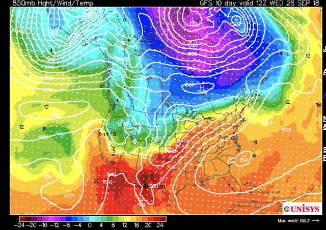
On the other hand there is a very stubborn and persistent south east ridge (high pressure system) that continues to funnel heat from Texas into the midwest. The problem is that as we approach the fall equinox, the lower sun angle should help reduce the severity of the heat that we receive even as the ridge persists. Take a look at this:
Also take a look at the projected temperatures as measured against the average for the month of September:
As you can see, although the temperatures are above average the overall trend is downward.
The long term looks tricky. The National Weather Service say this:
.LONG TERM (Wednesday Night Through Sunday)...
Issued at 237 PM EDT Sun Sep 16 2018

Models are close enough that the model blend initialization
was accepted for most items.

An upper ridge should keep Wednesday night & Thursday dry, then a
couple of fronts will bring chances for rain into next weekend.
Models are still differing on timing and location of fronts, so
confidence remains low in the PoPs.

Above normal temperatures early in the long term will give way to
seasonable values for next weekend.


No comments:
Post a Comment