The rollercoaster never ends! 40MPH winds, 1-2 inches of rain, thunderstorms tonight and tomorrow with a high of 60 degrees followed by near-freezing temperatures tomorrow night.
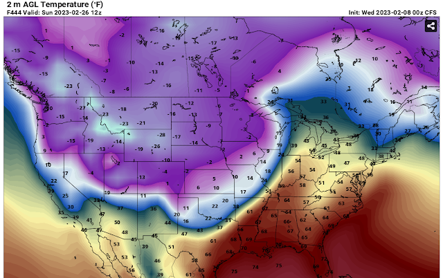
So where is winter? It's in Canada and in the north pole until about February 26th and then it will start to pay us a visit again.
There are hints of a snowstorm around March 5th. #BOTS!
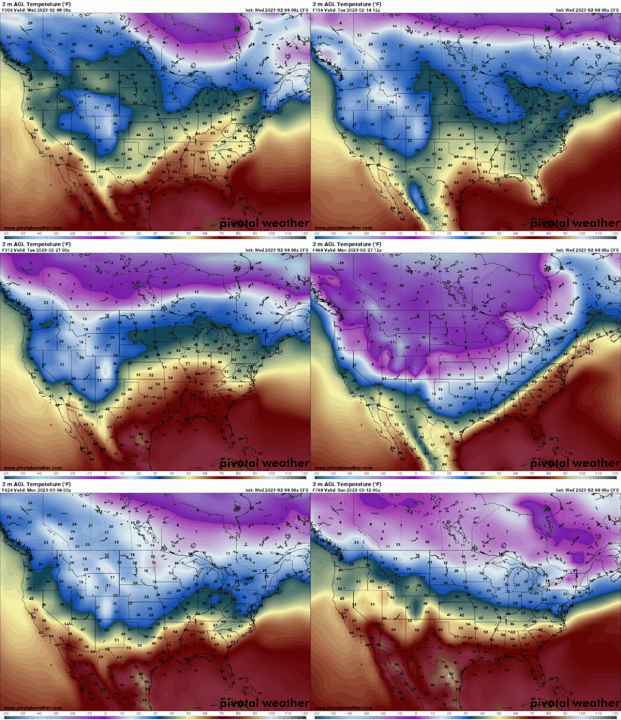
Do you want to see the rollercoaster? Here are 768 hours of it, or about 32 days. It's not precise but you'll get the point.
Here is what the National Weather Service out of Indianapolis is thinking:
Short Term...(Today and tonight)
Issued at 342 AM EST Wed Feb 8 2023

Much of the day today will be calm as surface high pressure makes
it`s way through central Indiana. Winds this morning will be light
and variable as a result with partly cloudy skies to start off the
day. High temperatures today are expected to reach the upper 40s to
the low 50s.

A deepening low pressure system with a developing LLJ of 60-70 kts
will be moving into the region from the SW through the day. It will
bring with it rain, thunderstorms, and gusty winds both non-
thunderstorm and within the storms. The models look to be in good
general agreement on the placement of the low tracking just to the
east and then north of the forecast area, placing central Indiana in
the warm moist sector. Chances for rain will begin in our far SW
this afternoon, overspreading the whole area by the late evening
hours. As the associated warm front moves through, look to see
temperatures warm overnight and approaching 60 degrees by daybreak.
Non-thunderstorm winds will also be increasing through the night.
Expect gusts to increase above 20 mph after 8pm and then to increase
to 30 to 45 mph from midnight to daybreak Thursday. Within
individual thunderstorms, there could be isolated gusts higher than
45 mph after midnight as winds mix down.

Within this system, expect ample moisture transport supported by the
LLJ and leading to QPF values from three-quarters to 1.25 inches
with locally higher amounts possible.

&&

.Long Term...(Thursday through Tuesday)
Issued at 342 AM EST Wed Feb 8 2023

...HIGH WIND WATCH THURSDAY...

...WINDY/RAINY THURSDAY...

Thursday...

Models in great agreement that an occluded system/stacked low will
be over west central Illinois Thursday morning and move across Lake
Michigan, lower Michigan and to northern Lake Huron by Thursday
evening. Warm conveyor belt moisture will be near and northeast of
Interstate 65 Thursday morning and quickly move northeast of the
area during the afternoon along with the occluded front. Thus, will
start the day off with widespread rain near and northeast of the I-
65 corridor with residual chance PoPs southeast as a buffer.
Elevated instability within the warm conveyor belt supports thunder
mention, while strong pressure gradient lends good confidence to
non-thunderstorm wind gusts greater than 45 mph. After inter-office
coordination, will issue a Wind Advisory over our southern tier
and keep the current Watch in place further north from 12z-00z and
expand it one tier south. With the low level jet nosing into south
central Indiana, will start the Advisory at 09z

In addition to the wind threat, localized flooding may be ongoing
from the previous night`s rain with storm total rainfall in
excess of an inch over most of central Indiana based on the
combination of strong synoptic lift, deep moisture and elevated
instability. That said, moisture and lift associated with a TROWAL
should remain far enough north of the area for any wraparound with
central Indiana entrenched in the dry conveyor belt in the wake of
the occluded front.

Temperatures will start off very mild for this time of year but
quickly fall during the afternoon with a result of well above normal
and early day highs in the 50s to lower 60s but readings falling
through the 40s during the afternoon.

Thursday night...

As the occluded system moves well northeast of central Indiana, a
weak ridge will pass across from the southwest Thursday night and
combined with some drying of the column per BUFKIT soundings will
result in a dry Thursday night with west winds, albeit it weakening,
bringing back colder yet still above normal temperatures with
overnight lows in the 30s.

Friday and Friday Night...

Broad upper trough will slide southeast across the Great Lakes and
Ohio Valley. However, an embedded southwest upper low will result in
an non-phased system and in lack of Gulf inflow. Thus, kept only
small
Pops in for Friday. Modest north winds around a Plains and Missouri
Valley surface ridge will only allow temperatures to climb a few
degrees with slightly above normal highs in the upper 30s NW to
middle 40s SE. Meanwhile, overnight lows will fall back below
freezing to the middle and upper 20s with the N winds continuing and
some clearing as the ridge gets closer and column dries out per
BUFKIT soundings.

Rest of the weekend...

Ridging and will remain over the region through the
weekend and BUFKIT is indicating a dry column. This will result
in little cloud cover but with northeast winds, seasonable
temperatures Saturday. As the high moves by, the winds will shift to
the southwest and albeit less than 10 knots, help raise the
temperatures to well above normal with afternoon highs in the 40s
Sunday.

Monday through Tuesday night...

An upper wave will move across the Great Lakes Monday but with
moisture lacking, supply no more than increasing cloud cover.
However, Tuesday into Tuesday night, a strong southern system will
tap into the Gulf and pivot northeast across the Missouri and
Wabash Valleys Tuesday and Tuesday night. This system has the
potential for more widespread rain along with mild temperatures.
Stay tuned.


No comments:
Post a Comment