Following his wishes, we held a graveside service with at the Winter family plot in the Springfield City Cemetery. Old Man Winter was a modest, private man and wanted it that way. He is survived by his two melting children; Snow-man and Snow-woman.
______
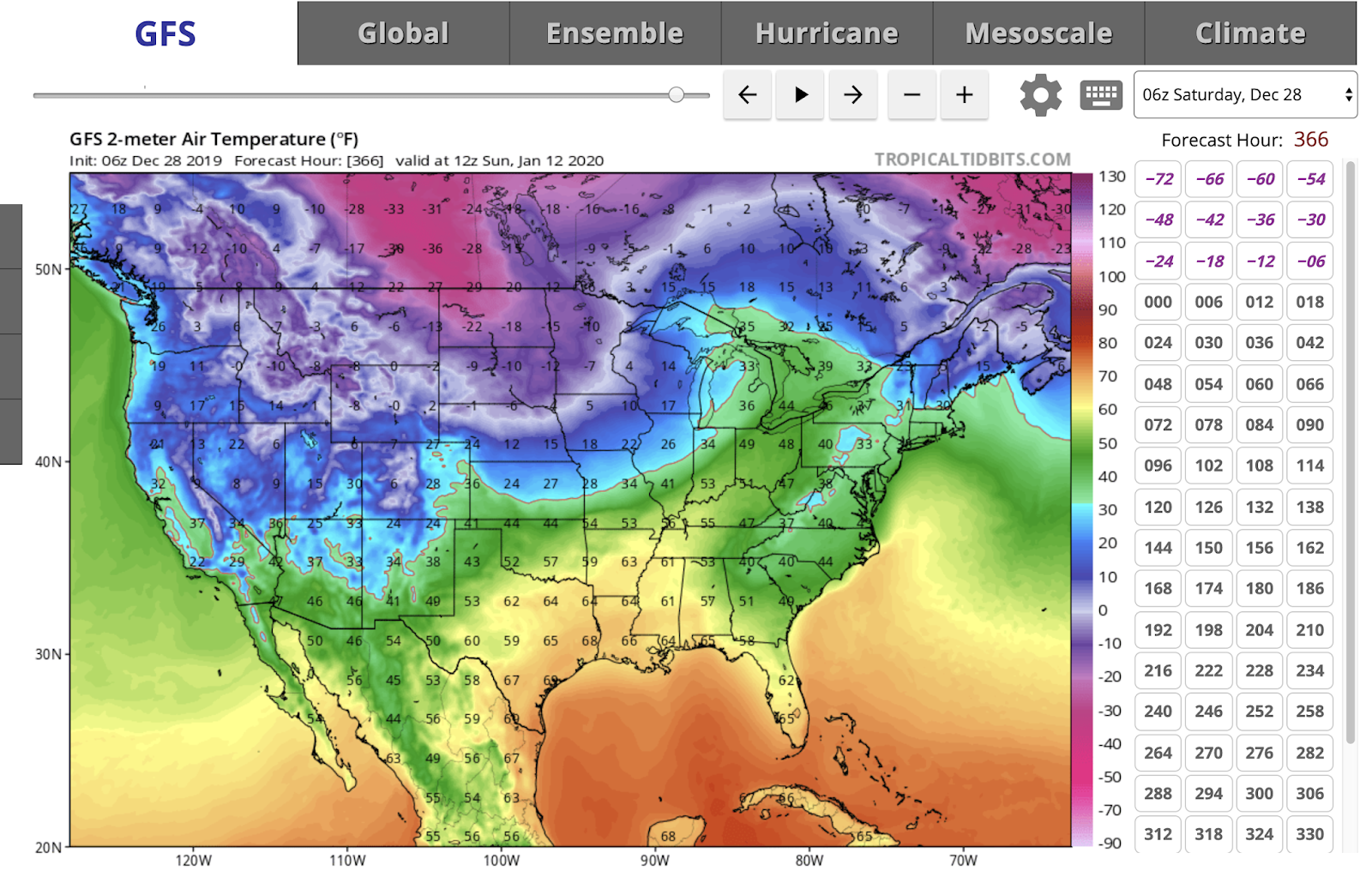
Check out the above average temperatures for the next two weeks.

From the NWS:
LONG TERM /Tuesday through Friday Night/...

Issued at 352 AM EST Sat Dec 28 2019

After a few lingering rain and snow showers (NE third of central
Indiana) early Tuesday, high pressure will strengthen over the
region, and dry conditions can be expected late Tuesday through
Wednesday. Meanwhile, a weak warming trend will commence through
the period. High temperatures will start out in the upper 30s/low
40s on Tuesday and increase to the upper 40s/low 50s by Friday.
Overnight lows will also climb from the 20s on Tuesday night to
mid 30s by Friday night. After the dry period, focus will then
turn to the next system approaching from the southwest late in the
period, which will bring a more active pattern through the end of
the forecast period with chances for mainly rain showers and some
snow showers from Wednesday night through Friday.
No comments:
Post a Comment