Rain showers are likely today through Thursday night. After that, high tempratures will go into the low 80's for the weekend. Spring returns next week. If you didn't know this, we have two severe weather seasons here in central Indiana. They are in the Spring and in the Fall as both cold air and warm air fight it out, and that is exactly what is going to happen next week and the week after that. Finally, the fun and games begin on the last week of October. #BOTS!
Here's an example of a cold front moving through late next week. The GFS puts this near October 16.

Although the hazzard type says "NONE" in the sounding, the box to the left says "CLASSIC SUPERCELL".

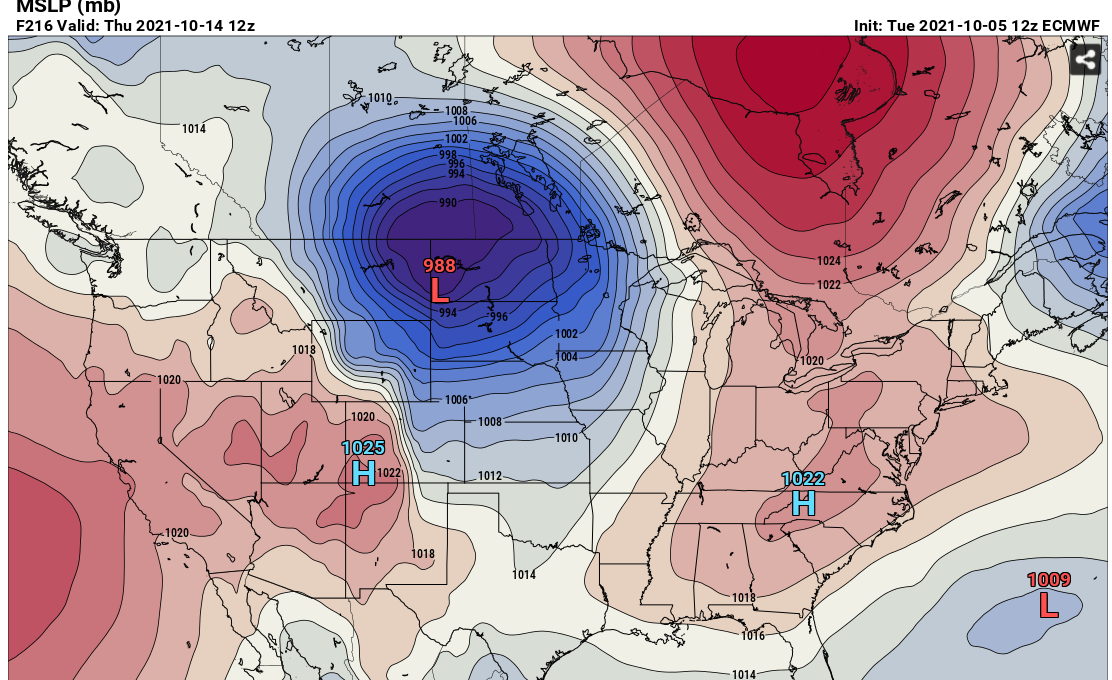
The European computer model does a great job of showing the contours and clashes of the competing air masses. Can you spot the battle zone?

The National Weather Service is saying this about the long term forecast:
.Long Term...(Thursday night through Tuesday)
Issued at 246 AM EDT Wed Oct 6 2021

Thursday night through Sunday.

By Thursday night, the aforementioned low pressure system will be
centered over Illinois with continued strong southerly surface flow
bringing in waves of moisture which is expected to interact with
plenty of forcing aloft to create scattered to widespread showers
through the night. The heaviest rain looks to fall earlier in the
day when the LLJ is strongest, but rain should continue through the
night. During the day Friday, the low is expected to weaken and
broaden out as it continues to move to the north and connect with
the polar jet.  Surface flow will remain southerly but at the 800 to
500mb layer, the moisture advection really begins to cut off which
looks to limit the intensity and coverage of precipitation. By
Saturday, the low will be fully integrated with the polar jet and
high pressure will begin to build across Indiana and the Ohio
Valley. Dry weather is then expected Saturday and Sunday.

Monday and Tuesday.

A more substantial fall system is expected Monday into Tuesday with
a strong upper level low deepening as it exits the lee of the
Rockies. Confidence in the system`s impacts for central Indiana
remains fairly low at this time with fairly significant model spread
on both the path and strength of the low as it moves across the
Central Plains.  The system has the potential to bring storms and
possibly severe weather as it moves into the Midwest and will have
to be monitored in the days to come.

Temperatures will gradually warm through the first part of the
period as the low exits and high pressure builds.  Early next week,
cooler temperatures are expected to return although still remaining
above normal.
No comments:
Post a Comment